 | |
USGS Open-File Report 2005-1162, Sidescan-Sonar Imagery and Surficial Geologic Interpretation of the Sea Floor off Bridgeport, Connecticut
Title Page | Introduction | Geologic Setting | Data/Processing | Bathymetry | Sidescan | Catalog | Figures | References| Contacts
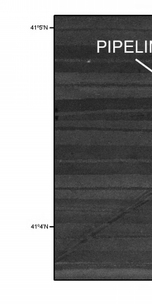 | 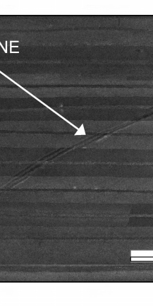 | 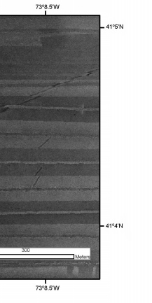 |
Figure 14. Detailed view of pipeline in the sidescan-sonar mosaic from the Bridgeport, Connecticut, study area. Location of this view is shown in fig 10. Figure 10. | ||