Other ID: K-1-68-SE; CORPUS 3, KANE
Status: Completed
Organization(s): USGS, Woods Hole Coastal and Marine Science Center
Funding Program(s):
Principal Investigator(s): Louis E. Garrison
Affiliate Investigator(s): M. BUELL - NVO
Information Specialist(s):
Data Type(s): Biological Field Study: Experiments (biological), Location-Elevation: Navigation, Sampling: Biology, Sampling: Geology, Seismics: Air Gun / Water Gun, Seismics: Sparker, Seismics: Sub Bottom Profiler
Scientific Purpose/Goals:
Vehicle(s):
Start Port/Location: Navy Yards, VA
End Port/Location: Willemstad, Curacao
Start Date: 1968-11-04
End Date: 1968-11-18
Equipment Used: Sparker , 3.5 kHz, Dredge, Omega navigation, Raytheon radar, Single channel hydrophone, Air gun, Piston corer
Information to be Derived:
Summary of Activity and Data Gathered: Daily Log-#3.
Staff: J. I. Ewing, I.G. Harkrider, J.F. Hernion, D.E. Miller
Affiliate Staff:
Minor Buell - Ch. Sci.; Bill Perkins - Princeton; Loomis - Princeton; Cliff Clive; Bob Randall; Jim Pew; John Freitag; Ed Escowitz; Troy Holcomb; Herb Eppert; Dee Stevenson - computer programmer; John Hanna - navigation; Bob Farland; Hawley Thomas - photographer; George; Bob Engler; Jim McQuay - Teledyne; Bob McCollum(?); Pete
Notes: InfoBank ID added 11/7/2017
Original Center People field contained: J.I. Ewing, J.F. Hernion, I.G. Harkrider, D.E. Miller.
Information from Foghorn: Airgun;sparker;3.5 kHz;dredge;Ewing piston corer;
Location:
Hatteras Abyssal Plain, North America, Silver Bank, Caicos Islands, Bahamas, Puerto Rico, Anegada Island, Venezuelan Basin, Curacao, Caribbean Sea, North Atlantic;
| Boundaries | |||
|---|---|---|---|
| North: 21.66833 | South: 13.63333 | West: -70.1117 | East: -68.05833 |
Platform(s):
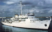 Elisha Kane |
| Title | Survey Equipment | Description |
|---|---|---|
| Cruise log | (document not focused on specific equipment) | Chief Scientist's daily log of data collection, equipment notes, ship movement, etc. |
| Survey Equipment | Survey Info | Data Type(s) | Data Collected |
|---|---|---|---|
| Sparker | --- | Sparker | |
| 3.5 kHz | --- | Sub Bottom Profiler | |
| Dredge | --- | Biology Geology | |
| Omega navigation | --- | Navigation | |
| Raytheon radar | --- | Navigation | |
| Single channel hydrophone | --- | Air Gun / Water Gun Boomer Bubble Gun Sparker Sub Bottom Profiler | |
| Air gun | --- | Air Gun / Water Gun | |
| Piston corer | --- | Geology |
