Other ID: 939009 Leg 3; CORPUS 8
Status: Completed
Organization(s): USGS, Woods Hole Coastal and Marine Science Center
Funding Program(s):
Principal Investigator(s): David Scholl
Affiliate Investigator(s):
Information Specialist(s):
Data Type(s): Location-Elevation: Navigation, Seismics: Sub Bottom Profiler, Sonar: Single Beam
Scientific Purpose/Goals:
Vehicle(s):
Start Port/Location:
End Port/Location:
Start Date: 1969-09-20
End Date: 1969-11-15
Equipment Used: Echosounder, Loran-A, 3.5 kHz
Information to be Derived: Bathymetric maps; Morphology;
Summary of Activity and Data Gathered:
Staff:
Affiliate Staff:
Notes: 160 K Seismic. No cruise report. Dates unresolved; listed variously as Aug. 1969 - Sept. 20, 1969, or Sept. 23, 1969 - Nov. 15, 1969.
Location:
Gulf of Mexico, United States, North America, North Atlantic;
| Boundaries | |||
|---|---|---|---|
| North: 30 | South: 18.31281 | West: -98 | East: -80.15625 |
Platform(s):
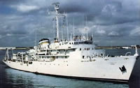 Elisha Kane |
| Survey Equipment | Survey Info | Data Type(s) | Data Collected |
|---|---|---|---|
| Echosounder | --- | Single Beam | 1969-008-FA-BA-001 (Bathymetric data in Infobank) |
| Loran-A | --- | Navigation | 1969-008-FA-LN-001 (Navigation data in InfoBank) |
| 3.5 kHz | --- | Sub Bottom Profiler |
