Other ID: UGEO Leg 3; CORPUS 17/18, U-03-71-CB, U0171CB
Status: Completed
Organization(s): USGS, Woods Hole Coastal and Marine Science Center
Funding Program(s):
Principal Investigator(s): Louis E. Garrison
Affiliate Investigator(s):
Information Specialist(s):
Data Type(s): Electro-Magnetic: Gravity, Electro-Magnetic: Magnetics, Location-Elevation: Navigation, Sampling: Biology, Sampling: Geology, Seismics: Sparker, Seismics: Sub Bottom Profiler
Scientific Purpose/Goals: Scientific objectives of this cruise leg were: (1) to investigate the zone of juncture between the south flank of the Antillean ridge and the north edge of the Venezuelan Basin along the depressed Muertos Trough; (2) to examine structural deformation in the Anegada Trough where the Greater Antilles are joined by the Lesser Antilles and Aves Swell; and (3) to study the northeastern sector of the Puetro Rico Trench where predicted relative plate motion should be transitional between westward underthrusting of the Lesser Antilles and east-west strike-slip motion north of the Greater Antilles.
Vehicle(s):
Start Port/Location: San Juan, Puerto Rico
End Port/Location: St. Thomas, U.S. Virgin Islands
Start Date: 1971-07-15
End Date: 1971-08-04
Equipment Used: Sparker , ITT 4007 satellite navigation, Magnetometer (wh), Gravity meter (wh), Decca radar system, 3.5 kHz, Single channel hydrophone, Dredge
Information to be Derived:
Summary of Activity and Data Gathered: Sub-bottom acoustic profiles were obtained over about 5,840 km of track line in the project area. One dredging station was occupied and three sonobuoy refraction profiles made. Total geophysical track miles: 3,028 (5,840 km); Time Log: #17a; Seismic Log: #17b; Gravity Log: #17c; Bathymetry Log: #17d; and Daily Log: #17e.
Staff: Louis E. Garrison, Ray G., Jr. Martin, James V. A. Trumbull
Affiliate Staff:
PMG - Mike Marlow
Allan Cooper
Robert Immel
Bob Patrick
Martin Hijmans
Trevor Hill
Notes: Data holdings at PCMSC.
Original Center People field contained: Louis Garrison - Chief Scientist, James Trumbull, Mike Marlow, Ray Martin, Allen Cooper, Robert Immel, Bob Patrick, Martin Hijmans, Trevor Hill.
Project = International Decade of Ocean Exploration (IDOE), International Decade of Ocean Exploration (IDOE)
Location:
eastern Greater Antilles, northeast Caribbean Sea, North America, North Atlantic;
| Boundaries | |||
|---|---|---|---|
| North: 30.2871 | South: 15.375 | West: -68.9967 | East: -58.5853 |
Platform(s):
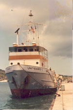 United Geo I |
Garrison, L.E., 1972, Acoustic reflection profiles, Eastern Greater Antilles, International Decade of Ocean Exploration, Leg 3, 1971 cruise, UNITEDGEO I: , USGS-GD-72-004, PB-207-596. 19 p.
| Title | Survey Equipment | Description |
|---|---|---|
| Cruise report | (document not focused on specific equipment) | Minimal information. Does indicate the other various logs maintained. |
| Survey Equipment | Survey Info | Data Type(s) | Data Collected |
|---|---|---|---|
| Sparker | --- | Sparker | |
| ITT 4007 satellite navigation | --- | Navigation | 1971-003-FA-LN-002 (Zip file of trackchart maps) 1971-003-FA-LN-001 (Navigation data in InfoBank) |
| Magnetometer (wh) | --- | Magnetics | NGDC MGD77 data 1971-003-FA-GP-001 (Gravity and magnetic data in InfoBank) |
| Gravity meter (wh) | --- | Gravity | NGDC MGD77 data |
| Decca radar system | --- | Navigation | |
| 3.5 kHz | --- | Sub Bottom Profiler | 1971-003-FA-BA-001 (Bathymetric data in InfoBank) NGDC MGD77 data |
| Single channel hydrophone | --- | Air Gun / Water Gun Boomer Bubble Gun Sparker Sub Bottom Profiler | 1971-003-FA-SE-001 (analog tape of seismic data) 1971-003-FA-SE-003 (zip archive of scanned records sections used for publication (includes lines 1-50)) 1971-003-FA-SE-002 (zip archive of scanned record sections for line 35-46) |
| Dredge | --- | Biology Geology |
