Other ID: none
Status: Completed
Organization(s): USGS, Woods Hole Coastal and Marine Science Center
Funding Program(s):
Principal Investigator(s): Charles J. O'Hara, Robert N. Oldale
Affiliate Investigator(s):
Information Specialist(s):
Data Type(s): Sampling: Geology
Scientific Purpose/Goals: Obtain vibracores in Cape Cod Bay using Alpine Electric Vibracore System.
Vehicle(s):
Start Port/Location: Woods Hole, MA
End Port/Location: Woods Hole, MA
Start Date: 1974-06-18
End Date: 1974-06-23
Equipment Used: Alpine Vibracorer
Information to be Derived: Grain size analysis; Sea floor map; Morphology;
Summary of Activity and Data Gathered: Collected 28 vibracores, bathymetry, gravity, magnetics, and seismic data.
Staff: Robert N. Oldale, Wayne Ferrebee, Raymond E. Hall, Frank W. Jennings, Charles Meeder, Charles J. O'Hara
Affiliate Staff:
Michael Sampson - Geologist
MA Dept. of Natural Resources; David Barnes - UWM
Notes:
Project = MA Co-op, MA Co-op
Location:
Cape Cod Bay, Massachusetts, United States, North America, North Atlantic,
| Boundaries | |||
|---|---|---|---|
| North: 42.16883216 | South: 41.74718127 | West: -70.68328857 | East: -70.10312868 |
Platform(s):
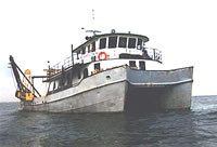 Atlantic Twin |
Oldale, R.N., and O'Hara, C.J., 1990, Maps showing the geology of the inner continental shelf, Cape Cod Bay, Massachusetts: U.S. Geological Survey Miscellaneous Field Studies Map MF-2118, 4 sheets, URL: https://doi.org/10.3133/mf2118.
| Title | Survey Equipment | Description |
|---|---|---|
| Vibracore log | Alpine Vibracorer | Vibracoring Log Description and seismic profile detail of site. |
| Survey Equipment | Survey Info | Data Type(s) | Data Collected |
|---|---|---|---|
| Alpine Vibracorer | --- | Geology | 1974-005-FA-SC-002 (Sediment Texture Descriptions (pdf file) Sediment Texture Laboratory work sheets.) 1974-005-FA-SC-001 (Core Descriptions (pdf file) Geologic descriptions of vibracores.) |
