Other ID: FAY 018
Status: Completed
Organization(s): USGS, Woods Hole Coastal and Marine Science Center
Funding Program(s):
Principal Investigator(s): Lyle D. McGinnis
Affiliate Investigator(s):
Information Specialist(s): Stanley Locker
Data Type(s): Electro-Magnetic: Gravity, Electro-Magnetic: Magnetics, Location-Elevation: Navigation, Seismics: Air Gun / Water Gun, Seismics: Sparker, Seismics: Sub Bottom Profiler
Scientific Purpose/Goals: Geophysical reconnaissance of the southeast Georgia Embayment for regional environmental analyses.
Vehicle(s):
Start Port/Location: Charleston, SC
End Port/Location: Charleston, SC
Start Date: 1976-07-02
End Date: 1976-07-15
Equipment Used: Air gun, 3.5 kHz, Marine magnetometer, Gravity meter (wh), Teledyne single-channel 300-500J 40-tip minisparker, Integrated Navigation System, Single channel hydrophone
Information to be Derived: Morphology;
Summary of Activity and Data Gathered: 13 lines were run normal to the coastline between 33 N and 29 30 N. Two lines comprised one long tie-line parallel to the shelf break. In addition, four short lines were run in the area between latitude 30 40 N to 31 10 N and longitudes 80 30 W to 80 W. The lines and numbering system was continued from FAY Cruise 017 to the north at 18. Lines on 018 were numbered from 18 to 32 and the dogleg following each line was considered part of the preceeding line. 12 sonobuoy refraction profiles were completed along lines 31 and 32, all on the Blake Plateau. Sonobuoy stations were numbered from 2 to 13 with #2 on the north and #13 on the south. 3.5 kHz: 2515 km; Sparker: 2808 km; Airgun: 3019 km; Sonobuoy: 12 stations, 268 km; Magnetics: 3019 km; Gravity: 2848 km.
Staff: Sandra Conley, Frank W. Jennings, Kathleen Kent, Lyle D. McGinnis, Stanley Locker
Affiliate Staff:
Lin Morse - watchstander
Rob Pexton - watchstander
Scott Heald - nav.
Felicity Oram - tech.
Gerard McCarthy - tech.; Richard Gardner - watchstander
USGS-WRD Montgomery; William Patterson - watchstander
USGS-Denver (Phoenix); Don Moller - ch. nav.
WHOI; Paul Bereznak - nav.
Western Geophysical
Notes: Original Center People field contained: Lyle D. McGinnis - Ch. Sci., Stanley D. Locker - ch. watchstander/cruise curator, Sandra Conley - watchstander, Lin Morse - watchstander, Rob Pexton - watchstander, Scott Heald - nav., Kathy Kent - nav., Frank Jennings - ch. tech., Felicity Oram - tech., Gerard McCarthy - tech.
Location:
southeast Georgia Embayment, Georgia, United States, North America, North Atlantic;
| Boundaries | |||
|---|---|---|---|
| North: 33.14470588 | South: 29.43003005 | West: -81.36485264 | East: -76.89572835 |
Platform(s):
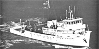
 Fay |
O'Hara, C.J., and Oldale, R.N., 1987, Maps showing geology, shallow structure, and bedform morphology of Nantucket Sound, Massachusetts: U.S. Geological Survey Miscellaneous Field Studies Map MF-1911, 4 sheets, URL: https://doi.org/10.3133/mf1911.
Paskevich, V.F., and Soderberg, N.K., 1997, Navigation and geophysical data collected onboard the R/V Fay from 1975-1976: U.S. Geological Survey Open-File Report 97-512, CD-ROM, URL: https://doi.org/10.3133/ofr97512.
Popenoe, P., 1991, Maps and cross sections depicting the shallow seismic stratigraphy of the continental shelf and slope off Georgia from interpretation of high-resolution seismic-reflection data: U.S. Geological Survey Open-File Report (91-397), 35 p., https://doi.org/10.3133/ofr91397.
Popenoe, P., and Manheim, F.T., 2001, Origin and history of the Charleston Bump--geological formations, currents, bottom conditions, and their relationship to Wreckfish habitats on the Blake Plateau, in Sedberry, G.R., ed., Island in the Stream--Oceanography and Fisheries of the Charleston Bump: American Fisheries Society Symposium, v. 25.
Popenoe, P., and Spalding, J.S., 1988, Isopach and structure contour maps of the Miocene and post-Miocene sediments in the southeast Georgia Embayment, Florida-Hatteras Shelf, offshore Georgia: U.S. Geological Survey Open-File Report 88-397, 12 p., https://doi.org/10.3133/ofr88397.
| Title | Survey Equipment | Description |
|---|---|---|
| Cruise report | (document not focused on specific equipment) | Chief Scientist's cruise summary of ship movement, personnel, equipment and data acquisition notes. Includes trackmaps. |
| Survey Equipment | Survey Info | Data Type(s) | Data Collected |
|---|---|---|---|
| Air gun | --- | Air Gun / Water Gun | |
| 3.5 kHz | --- | Sub Bottom Profiler | 1976-023-FA-BA-001 (Digital tape(s) of NV-INS, MG, NV-FINAL, BT-FINAL, GR, GR-FINAL, NV-FIX-FINAL, ) 1976-023-FA-SE-001 (film collection of 3.5) |
| Marine magnetometer | --- | Magnetics | |
| Gravity meter (wh) | --- | Gravity | 1976-023-FA-GP-001-01 (Gravity and Magnetic data) |
| Teledyne single-channel 300-500J 40-tip minisparker | --- | Sparker | |
| Integrated Navigation System | --- | Navigation | 1976-023-FA-LN-001-03 (Scans of various trackmaps for FAY 018 (TIFs and PDFs).) 1976-023-FA-LN-001-02 (Southern Track Map (pdf file) Trackline map for Lines 18-30 with 15 minute fixes.) 1976-023-FA-LN-002-01 (Navigation data) 1976-023-FA-LN-001-01 (Northern Track Map (pdf file) Trackline map for northern lines with 15 minute fixes.) |
| Single channel hydrophone | --- | Air Gun / Water Gun Boomer Bubble Gun Sparker Sub Bottom Profiler | 1976-023-FA-SE-002 ( Collection of paper record displays of seismic data( AIR) for lines ) 1976-023-FA-SE-005-01 (Paper record section of Lines 18, ) 1976-023-FA-SE-004 (analog tape of seismic data) 1976-023-FA-SE-003 (microfilm of ) |