Other ID: W-39, Leg 4
Status: Completed
Organization(s): USGS, Woods Hole Coastal and Marine Science Center
Funding Program(s):
Principal Investigator(s): Charles E. McClennen
Affiliate Investigator(s): Arthur G. Gaines, Jr. - SEA
Information Specialist(s):
Data Type(s): Sonar: Sidescan, Seismics: Sub Bottom Profiler, Location-Elevation: Navigation
Scientific Purpose/Goals: USGS cruise (4 days) piggybacked on SEA cruise to conduct sidescan sonar and high-resolution seismic reflection surveys of a west-east transect across the South Carolina shelf off Charleston and a more extensive survey of the Mud Patch on the southern New England shelf.
Vehicle(s):
Start Port/Location: Charleston, SC
End Port/Location: Woods Hole, MA
Start Date: 1978-05-14
End Date: 1978-05-24
Equipment Used: ORE sidescan, Raytheon RTT 1000 Seismic System, Loran-A, Loran-C
Information to be Derived: Sea floor map; Morphology;
Summary of Activity and Data Gathered: No clear sub-bottom reflectors were noted in the entire survey of the southern New England shelf. In part this reflects limitations of the profiling equipment although better records might have been obtained at slower speeds with greater submergence of the transducer. Sidescan sonar: 368 km; Sub-bottom profiles: 368 km.
Staff: Charles E. McClennen
Affiliate Staff:
SEA: Arthur G. Gaines
Jr. - co-Ch. Sci.
Stephen Bekowitz - scientist
Anne Brearley - scientist
Carol Reinisch - scientist
24 SEA students
Notes: Original Center People field contained: Charles E. McClennen - co-Ch. Sci.
Location:
South Carolina, Southern New England Continental Shelf, Mud Patch, United States, North America, North Atlantic;
| Boundaries | |||
|---|---|---|---|
| North: 41.6 | South: 32.5 | West: -80 | East: -70.5 |
Platform(s):
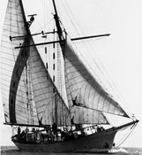 Westward |
McClennen, C.E., 1981, Sidescan-sonar data collected during May 1978 from the southern New England continental shelf: U.S. Geological Survey Open-File Report 1981-1127, 2 p., https://doi.org/10.3133/ofr811127.
Twichell, D.C., McClennen, C.E., Butman, B., 1981, Morphology and processes associated with the accumulation of the fine-grained sediment deposit on the southern New England shelf: Journal of Sedimentary Petrology, v. 51 no. 1, doi: 10.1306/212F7C6B-2B24-11D7-8648000102C1865D.
| Title | Survey Equipment | Description |
|---|---|---|
| Cruise report | (document not focused on specific equipment) | Chief Scientist's cruise report of ship movement, equipment and data acquisition notes, personnel activities, and trackmaps. |
| Survey Equipment | Survey Info | Data Type(s) | Data Collected |
|---|---|---|---|
| ORE sidescan | --- | Sidescan | 1978-011-FA-SO-002 (microfilm of ) 1978-011-FA-SO-001 ( Collection of paper record displays of sidescan sonar data for lines ) |
| Raytheon RTT 1000 Seismic System | --- | Sub Bottom Profiler | |
| Loran-A | --- | Navigation | |
| Loran-C | --- | Navigation | 1978-011-FA-LN-001 (Navigation trackline plot for field activity 78011) |
