Other ID: 78-G7; 78-G-7
Status: Completed
Organization(s): USGS, Woods Hole Coastal and Marine Science Center
Funding Program(s):
Principal Investigator(s): Michael Bothner
Affiliate Investigator(s):
Information Specialist(s): Richard Rendigs
Data Type(s): Environmental Data: CTD, Environmental Data: Turbidity, Location-Elevation: Navigation, Sampling: Chemistry, Sampling: Geology, Seismics: Sub Bottom Profiler, Time Series: Mooring (physical oceanography)
Scientific Purpose/Goals: Collect hydrographic and suspended matter data on Georges Bank and continental shelf areas off the New England and Middle Atlantic States. This is an ongoing study to determine the seasonal distribution and composition of suspended matter along the eastern seaboard. Additional cruise objectives were the deployment and recovery of three moorings with attached current meters and sediment traps. Sediment samples were collected at three locations with a grab sampler and with a hydrostatically damped gravity corer.
Vehicle(s):
Start Port/Location: Woods Hole, MA
End Port/Location: Woods Hole, MA
Start Date: 1978-08-19
End Date: 1978-09-01
Equipment Used: Gravity corer, Niskin bottle, Montedoro Whitney transmissometer with nephelometer, CTD 19+ with OBS, PAR, DO, Chl, Turner 110 Fluorometer, Van Veen grab sampler, Current, Northstar 6000 LORAN-C, Loran-A, 3.5 kHz
Information to be Derived: Grain size analysis; Time series data; Samples and chemical analysis; Suspended sediment concentrations;
Summary of Activity and Data Gathered: Stations: 13; XBT (underway): 127; CTD/Transmissometer/suspended matter stations: 116; Sediment trap arrays: 3; 24-hour monitoring stations: 3; Suspended Matter Millepore samples: 286; Suspended Matter Nucleopore samples: 187; Suspended Matter Mineralogy samples: 79; Chlorophyll samples: 276; Nutrient samples: 274; Grab samples: 4; Cores: 3. Moorings deployed and recovered: 3 (#154, VACM w/transmissometer; 2 current meters w/ sediment traps).
Staff: Michael Bothner, Wayne Ferrebee, Peter Johnson, Carol M. Parmenter, Lawrence Poppe, Richard Rendigs
Affiliate Staff:
William Doonan
John McClane
Nora Thom; Andrew Eliason - Eliason Data Services; Dave Strimaitis - Energy Resources Co.; Jack Becktold
Frank O'Hara - Texas A&M University; Pat Collins - WHOI
Notes: Original Center People field contained: Mike Bothner - Ch. Sci.; William Doonan, Wayne Ferrebee, Peter Johnson, John McClane, Carol Parmenter, Lawrence Poppe, Richard Rendigs, Nora Thom.
Project = North and Middle Atlantic OCS Environmental Assessment, North and Middle Atlantic OCS Environmental Assessment
Information from Foghorn: Rosette multi-bottle array;Montedoro Whitney transmissometer with nephelometer;Neil Brown CTD with dissolved oxygen sensor;Esterline-Angus recorders for deck readouts;Turner 110 Fluorometer;Hydrostatically damped gravity corer;Van Veen grab sampler;current meter (VACM);Acoustic release (AMF);
Location:
Georges Bank, Mud Patch, Middle Atlantic Outer Continental Shelf, Massachusetts, New Jersey, United States, North America, North Atlantic;
| Boundaries | |||
|---|---|---|---|
| North: 41.9 | South: 38.4 | West: -74 | East: -67 |
Platform(s):
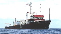
 Gyre |
Bothner, M.H., Parmenter, C.M., Rendigs, R.R., Butman, B., Poppe, L.J., Milliman, J.D., 1982, Studies of suspended matter along the North and Middle Atlantic outer continental shelf: U.S. Geological Survey Open-File Report 82-938, https://doi.org/10.3133/ofr82938.
Twichell, D.C., McClennen, C.E., Butman, B., 1981, Morphology and processes associated with the accumulation of the fine-grained sediment deposit on the southern New England shelf: Journal of Sedimentary Petrology, v. 51 no. 1, doi: 10.1306/212F7C6B-2B24-11D7-8648000102C1865D.
| Title | Survey Equipment | Description |
|---|---|---|
| Cruise report | (document not focused on specific equipment) | Chief Scientist's cruise report including personnel, equipment, cruise narrative, station locations, bridge log, weather log, and trackmap. |
| Survey Equipment | Survey Info | Data Type(s) | Data Collected |
|---|---|---|---|
| Gravity corer | Hydrostatically damped gravity corer | Geology | |
| Niskin bottle | --- | Chemistry | |
| Montedoro Whitney transmissometer with nephelometer | --- | Turbidity | |
| CTD 19+ with OBS, PAR, DO, Chl | --- | CTD | |
| Turner 110 Fluorometer | --- | Turbidity | |
| Van Veen grab sampler | --- | Geology | |
| Current | --- | Mooring (physical oceanography) | |
| Northstar 6000 LORAN-C | --- | Navigation | 1978-024-FA-NL-001 (Logs for 3.5K, ) |
| Loran-A | --- | Navigation | |
| 3.5 kHz | --- | Sub Bottom Profiler | 1978-024-FA-SE-002 (microfilm of ) 1978-024-FA-SE-001 ( Collection of paper record displays of seismic data( 3.5K) for lines ) |