Other ID: 68
Status: Completed
Organization(s): USGS, Woods Hole Coastal and Marine Science Center
Funding Program(s):
Principal Investigator(s): Charles W. Holmes
Affiliate Investigator(s):
Information Specialist(s):
Data Type(s): Sonar: Sidescan, Seismics: Boomer, Seismics: Sparker, Imagery: Video, Location-Elevation: Navigation
Scientific Purpose/Goals: Obtain high-resolution data from the southern shelf of St. Croix, obtain sidescan sonar data on the southern shelf of St. Thomas, and place sediment trap arrays at selected sites.
Vehicle(s):
Start Port/Location:
End Port/Location:
Start Date: 1978-11-01
End Date: 1978-11-18
Equipment Used: Single channel hydrophone, Klein 531 sidescan, Boomer, Del Norte 26 sparker, Camera - B/W video, Motorola Mini-Ranger III
Information to be Derived: Suspended sediment concentrations; Sea floor map; Morphology;
Summary of Activity and Data Gathered: Operated only in daylight. Due to high winds and resultant seas, high-resolution data quality is poor to fair; sidescan sonar data is fair. Sidescan sonar: 26 km, fair quality; Uniboom: 50 km, poor to fair quality; TV Tape: 6 hours; Grab samples: 25; SARIMA Time Log #68.
Staff: Charles W. Holmes, Ronald J. Miller, John West, George Wiley
Affiliate Staff:
Notes: Original Center People field contained: USGS-Corpus Christi: Charles (Chuck) W. Holmes - Ch. Sci., Jack Kindinger, Ronald Miller, John West, George Wiley.
Location:
St. Croix shelf, St. Thomas shelf, U..S. Virgin Islands, Caribbean Sea, United States, North America, North Atlantic;
| Boundaries | |||
|---|---|---|---|
| North: 18.3 | South: 17.6 | West: -65.1 | East: -64 |
Platform(s):
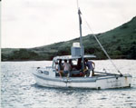 Sarima |
| Title | Survey Equipment | Description |
|---|---|---|
| Cruise report | (document not focused on specific equipment) | Chief Scientist's cruise summary equipment and brief data acquisition notes, personnel, and track map. |
| Survey Equipment | Survey Info | Data Type(s) | Data Collected |
|---|---|---|---|
| Single channel hydrophone | --- | Air Gun / Water Gun Boomer Bubble Gun Sparker Sub Bottom Profiler | |
| Klein 531 sidescan | --- | Sidescan | |
| Boomer | --- | Boomer | |
| Del Norte 26 sparker | --- | Sparker | |
| Camera - B/W video | --- | Video | |
| Motorola Mini-Ranger III | --- | Navigation |
