Other ID: NE-4-79
Status: Completed
Organization(s): USGS, Woods Hole Coastal and Marine Science Center
Funding Program(s):
Principal Investigator(s): Deborah Hutchinson
Affiliate Investigator(s):
Information Specialist(s):
Data Type(s): Location-Elevation: Navigation, Sampling: Geology, Seismics: Sub Bottom Profiler, Sonar: Sidescan
Scientific Purpose/Goals: 1. Collect high-resolution and airgun seismic reflection profiles and magnetic profiles over western Lake Ontario to identify geologic hazards that might be related to the low-intensity earthquake activity in western New York. 2. Collect Alpine piston cores to correlate lithology with acoustic stratigraphy and measure paleomagnetic vectors. 3. Collect Van Veen grab samples for specific bottom types.
Vehicle(s):
Start Port/Location: Wilson, NY
End Port/Location:
Start Date: 1979-06-19
End Date: 1979-07-10
Equipment Used: Edo Western Sidescan and 2.5 kHz sub-bottom system, Loran-C, GPS (wh), Piston corer, 2.5 kHz system (batfish)
Information to be Derived:
Summary of Activity and Data Gathered: Collected 18 lines of seismic data. 7 kHz data: 577 km; 2.5 kHz data: 577 km; 1 in. airgun data: 577 km; Sidescan data: 12 km; Magnetometer data: 542 km; Stations: 11; Piston cores: 15; Grab samples: 6.
Staff: Deborah Hutchinson, Frank W. Jennings, Kenneth F. Parolski
Affiliate Staff:
William Brennan
Visitor
SUNY-Geneseo (July 8)
Notes: Original Center People field contained: Debbie Hutchinson, Chief Scientist; Frank Jennings, Technician; Ken Parolski, Technician.
Project = Great Lakes, Great Lakes
Location:
western Lake Ontario, Great Lakes, New York, United States, North America;
| Boundaries | |||
|---|---|---|---|
| North: 43.54972 | South: 43.36667 | West: -78.9064 | East: -78.28972 |
Platform(s):
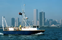
 Neecho |
| Title | Survey Equipment | Description |
|---|---|---|
| Cruise report | (document not focused on specific equipment) | Chief Scientist's daily log of ship movement, equipment and data acquisition notes, personnel activities, vessel performance, sample locations, equipment planning for future field work. |
| Survey Equipment | Survey Info | Data Type(s) | Data Collected |
|---|---|---|---|
| Edo Western Sidescan and 2.5 kHz sub-bottom system | --- | Sub Bottom Profiler Sidescan | 1979-014-FA-SE-003 (analog tape of seismic data) 1979-014-FA-SE-001 ( Collection of paper record displays of seismic data( 200K) for lines ) 1979-014-FA-SE-002 (microfilm of *SSS) |
| Loran-C | --- | Navigation | 1979-014-FA-LN-002 (Digital tapes of NV and NV-FINAL data: inv. # 1414, 1428, 1431, 1960, 1982 thru 1985, and 2052.) 1979-014-FA-LN-001 (Navigation trackline plot for field activity 79014) |
| GPS (wh) | --- | Navigation | |
| Piston corer | --- | Geology | 1979-014-FA-SC-001 (CORE samples) |
| 2.5 kHz system (batfish) | --- | Sub Bottom Profiler |