Other ID: GS 7903-6
Status: Completed
Organization(s): USGS, Woods Hole Coastal and Marine Science Center
Funding Program(s):
Principal Investigator(s): Peter Popenoe
Affiliate Investigator(s):
Information Specialist(s): Janet B. Burke
Data Type(s): Electro-Magnetic: Gravity, Electro-Magnetic: Magnetics, Location-Elevation: Navigation, Seismics: Air Gun / Water Gun, Seismics: Boomer, Seismics: Multichannel, Seismics: Sub Bottom Profiler
Scientific Purpose/Goals: Cape Hatteras area: High-resolution seismic profiling of the continental shelf, slope and rise for a regional assessment of environmental hazards to petroleum exploration and development. Nature and frequency of slumping, faulting, cut and fill, scour, sand waves, and karst topography were examined. Two lines were run to define a growth fault seen on deep CDP data in area. Offshore Georgia Continental Shelf: Survey conducted to assess possible pipeline corridor routes on the Georgia shelf. High-resolution seismic reflection data were used to assess Pleistocene river channels, scour, sand waves, cut and fill, faulting, shallow gas, and reefs and hardground development. Red Snapper Sink: Detailed high-resolution seismic lines were put across and near the sink to assess the seismic nature of the karst development in the area. Florida Shelf: A high-resolution seismic reflection profile was run between Red Snapper Sink and Cape Canaveral to trace the subsurface expression of the karst surface.
Vehicle(s):
Start Port/Location: Charleston, SC
End Port/Location: Miami, FL
Start Date: 1979-08-10
End Date: 1979-08-29
Equipment Used: Western Geophysical Integrated Navigation System, 3.5 kHz, EG&G 234, LaCoste-Romberg gravimeter G-179, Bell 5M-203 gravity meter, Geometrics G-856 magnetometer, Single channel hydrophone, Multichannel seismics, Air gun
Information to be Derived: Morphology;
Summary of Activity and Data Gathered: Airgun (1, 5, 20, and 40 cu. in. were used based on water depth and ringing problems): 3290 km; 3.5 kHz: 3290 km; Uniboom: 1352 km; Gravity: 4940 km; Magnetics: 1935 km.
Staff: Janet B. Burke, Elizabeth Coward, James E. Dodd, Alan Goodman, Barry Irwin, John Larson, Marshal Otter, Kenneth F. Parolski, Peter Popenoe
Affiliate Staff:
Robert Douthart - Tech.
Gerald McCarthy - tech.
Steven Schertzer - watch; David Geever - INS nav.
USGS/WHOI; David Mason - compressor tech.
USGS/WHOI
Notes: Original Center People field contained: Peter Popenoe - Ch. Sci., Janet Burke - cruise curator, Elizabeth Coward - watch, James Dodd - INS nav., Robert Douthart - Tech., Alan Goodman - tech., Barry Irwin - INS nav., John Larson - Tech., Gerald McCarthy - tech., Marshall Otter - watch, Kenneth Parolski - tech., Steven Schertzer - watch.
Project = Southeastern Atlantic OCS Environmental Assessment, Southeastern Atlantic OCS Environmental Assessment
Location:
Cape Hatteras, Cape Romain, North Carolina, Continental Shelf, Slope, Rise, Georgia Continental Shelf, Crescent Beach, Cape Canaveral, Florida Continental Shelf, Red Snapper Sink, United States, North America, North Atlantic;
| Boundaries | |||
|---|---|---|---|
| North: 35.05398268 | South: 28.3473614 | West: -81.30366373 | East: -74.50927734 |
Platform(s):
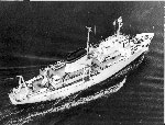 James M Gilliss |
Popenoe, P., 1983, High-resolution seismic reflection profiles collected August 4 to 28, 1979, between Cape Hatteras and Cape Fear, North Carolina, and off Georgia and northern Florida (Cruise GS-7903-6): U.S. Geological Survey Open-File Report 83-512, 3 p., URL: https://doi.org/10.3133/ofr83512.
Popenoe, P., 1991, Maps and cross sections depicting the shallow seismic stratigraphy of the continental shelf and slope off Georgia from interpretation of high-resolution seismic-reflection data: U.S. Geological Survey Open-File Report (91-397), 35 p., https://doi.org/10.3133/ofr91397.
Popenoe, P., and Spalding, J.S., 1988, Isopach and structure contour maps of the Miocene and post-Miocene sediments in the southeast Georgia Embayment, Florida-Hatteras Shelf, offshore Georgia: U.S. Geological Survey Open-File Report 88-397, 12 p., https://doi.org/10.3133/ofr88397.
| Title | Survey Equipment | Description |
|---|---|---|
| Cruise report | (document not focused on specific equipment) | Chief Scientist's cruise report of personnel, equipment, data acquisition narrative, daily log, and track chart. |
| Survey Equipment | Survey Info | Data Type(s) | Data Collected |
|---|---|---|---|
| Western Geophysical Integrated Navigation System | --- | Navigation | 1979-020-FA-LN-002 (Digital tape(s) of NV-NSTAR, NV,GR,MG, NV-INS, GR-L&R, UNKNOWN, NV-NSTAR-FINAL, ) 1979-020-FA-LN-001 (Navigation trackline plot for field activity 79020) 1979-020-FA-LN-002-01 (Zip archive of navigation data) |
| 3.5 kHz | --- | Sub Bottom Profiler | |
| EG&G 234 | --- | Boomer | |
| LaCoste-Romberg gravimeter G-179 | --- | Gravity | |
| Bell 5M-203 gravity meter | --- | Gravity | 1979-020-FA-GP-002-01 (geophysical data) 1979-020-FA-GP-002 (Digital tape(s) of NV-NSTAR, NV,GR,MG, NV-INS, GR-L&R, UNKNOWN, NV-NSTAR-FINAL, ) |
| Geometrics G-856 magnetometer | --- | Magnetics | 1979-020-FA-GP-001-01 (geophysical data) 1979-020-FA-GP-001 (Digital tape(s) of NV-NSTAR, NV,GR,MG, NV-INS, GR-L&R, UNKNOWN, NV-NSTAR-FINAL, ) |
| Single channel hydrophone | --- | Air Gun / Water Gun Boomer Bubble Gun Sparker Sub Bottom Profiler | 1979-020-FA-SE-004-01 (Paper record section of Lines 5, 6, 7, ) 1979-020-FA-SE-003 (analog tape of seismic data) 1979-020-FA-SE-002 (microfilm of ) 1979-020-FA-SE-001 ( Collection of paper record displays of seismic data( AIR) for lines ) |
| Multichannel seismics | --- | Multichannel | 1979-020-FA-SE-004-02 (SEGY data files) |
| Air gun | --- | Air Gun / Water Gun |
