Other ID: EN-042
Status: Completed
Organization(s): USGS, Woods Hole Coastal and Marine Science Center
Funding Program(s):
Principal Investigator(s): James M. Robb
Affiliate Investigator(s):
Information Specialist(s):
Data Type(s): Biological Field Study: Experiments (biological), Environmental Data: Temperature, Location-Elevation: Navigation, Seismics: Sub Bottom Profiler, Sonar: Single Beam, Sampling: Geology
Scientific Purpose/Goals: Purpose of this cruise was coring for geotechnical and sedimentological analysis of features on the continental slope. 32 stations were chosen by Conservation Division Hazard Analysis group within specific lease blocks in the Mid-Atlantic OCS area. 11 additional stations were occupied on the Mid-Atlantic slope and 11 on the North Atlantic (Georges Bank) slope.
Vehicle(s):
Start Port/Location: Narragansett, RI
End Port/Location: Narragansett, RI
Start Date: 1979-08-28
End Date: 1979-09-23
Equipment Used: Heat flow, Gravity corer, Northstar 6000 LORAN-C, 3.5 kHz, 12 kHz, Piston corer
Information to be Derived: Samples and chemical analysis; Grain size analysis; Sea floor map; Morphology;
Summary of Activity and Data Gathered: Gravity cores: 27; Piston cores: 71; Heat flow stations: 6; 3.5 kHz: 100 km; Total stations: 54 (North Atlantic = 11, Mid-Atlantic = 43).
Staff: John M. Aaron, James S. Booth, Joseph Botbol, Kathryn Scanlon Catanach, Ronald C. Circe, Richard Farrow, Wayne Ferrebee, Jean Hopson, Robert E. Miller, Charles J. O'Hara, Lawrence Poppe, Richard Rendigs, Tom Rice, James M. Robb, George Wiley
Affiliate Staff:
David Schultz - gas analysis
Rich Slater - coring crew
Jody Zelibor - gas analysis
Terry Lerch - replacement gas analysis; Rod Davies - coring super.
URI; Skip Rousell - coring super
URI; Mark Bernasconi - heat flow
WHOI; Skip Pelletier - heat flow
WHOI; Alan Driscoll and R. Boudreau onboard Aug. 28 to check winch and coring gear.
Notes: Original Center People field contained: John A. Aaron - co-Ch. Sci., Jim Robb - co-Ch. Sci., Jim Booth - geotech. super., Richard Farrow - geotech. super., W. Mack Ferrebee - core description, Chuck O'Hara - coring crew, Lawrence Poppe - core description, Tom Rice - coring crew, David Schultz - gas analysis, Rich Slater - coring crew, George Wiley - coring crew, Jody Zelibor - gas analysis; Replacements Sep. 8-23, 1979: Bob Miller - gas analysis, Terry Lerch - gas analysis, Joseph Botbol - coring crew, Ronald Circe - coring crew, Jean Hopson - coring crew, Richard Rendigs - coring crew, Kathy Scanlon - coring crew. Original Submitted By field contained: Jim Robb and John A. Aaron.
Project = Mid-Atlantic and North Atlantic Outer Continental Shelf Environmental Assessment, Mid-Atlantic and North Atlantic Outer Continental Shelf Environmental Assessment
Information from Foghorn: Piston corer, 3.5 in. diameter, 3000 or 2000 lb. core head;Gravity corer, PVC bbl, 4.5 in. sample diameter;
Location:
Baltimore Canyon, Hudson Canyon, Maryland, Delaware, New Jersey, Mid-Atlantic Continental Slope, southwest Georges Bank, North Atlantic Continental Slope, United States, North America, North Atlantic;
| Boundaries | |||
|---|---|---|---|
| North: 40.03789593 | South: 38 | West: -73.84152913 | East: -70.35 |
Platform(s):
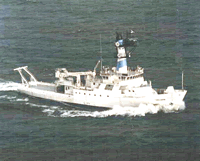 Endeavor |
Booth, J.S., Circe', R.C., and Dahl, A.G., 1984, Geotechnical characterization and mass-movement potential of the United States North Atlantic continental slope and rise: U.S. Geological Survey Open-File Report 85-123, https://doi.org/10.3133/ofr85123.
Poppe, L.J., 1984, X-ray mineralogy of cores from the North Atlantic and Mid-Atlantic continental slope and rise: U.S. Geological Survey Open-File Report 84-673, https://doi.org/10.3133/ofr84673.
| Title | Survey Equipment | Description |
|---|---|---|
| Cruise report | (document not focused on specific equipment) | Chief Scientist's cruise report of personnel, equipment and data acquisition notes, station and core list with locations. |
| Survey Equipment | Survey Info | Data Type(s) | Data Collected |
|---|---|---|---|
| Heat flow | --- | Temperature | |
| Gravity corer | --- | Geology | |
| Northstar 6000 LORAN-C | --- | Navigation | |
| 3.5 kHz | --- | Sub Bottom Profiler | 1979-026-FA-SE-001 (film collection of 3.5) |
| 12 kHz | --- | Single Beam | 1979-026-FA-SE-002 ( Collection of paper record displays of seismic data( 12KC) for lines ) 1979-026-FA-SE-003 (microfilm of ) |
| Piston corer | --- | Geology | 1979-026-FA-SC-001 (CORE samples) |
