Other ID: 80-G-6A
Status: Completed
Organization(s): USGS, Woods Hole Coastal and Marine Science Center
Funding Program(s):
Principal Investigator(s): Charles W. Holmes
Affiliate Investigator(s):
Information Specialist(s):
Data Type(s): Biological Field Study: Experiments (biological), Location-Elevation: Navigation, Sampling: Biology, Sampling: Geology, Seismics: Sparker, Seismics: Sub Bottom Profiler
Scientific Purpose/Goals: Obtain samples of the sediments on the Mississippi-Alabama shelf, the central Tampa shelf, and the Florida Strait slope in order to confirm areas of reported phosphate concentrations. Obtain high-resolution data on the Mississippi-Alabama shelf and the southern shelf (south of 26 degrees). Obtain drill cores of the central shelf area and southern reefs. Obtain a suite of piston cores on the central shelf.
Vehicle(s):
Start Port/Location: New Orleans, LA
End Port/Location: Miami, FL
Start Date: 1980-06-14
End Date: 1980-07-05
Equipment Used: 3.5 kHz, Sparker , Dredge, Grab sampler, Rotary core, Smith-MacIntyre grab, Box corer, Loran-C, Single channel hydrophone, Piston corer
Information to be Derived: Samples and chemical analysis;
Summary of Activity and Data Gathered: 3.5 kHz: 3507 km; Minisparker: 3292 km; Underway samples: 24; Dredge hauls: 8; Piston cores: 26; Drill cores: 2; Smith McIntyre grab: 4; Box cores: 5; Surface salinity measurements: 200; Mini-hydrocast: 12.
Staff: Paul Bowker, Raymond E. Hall, Charles W. Holmes, Barry Irwin, Frank T. Manheim, Ronald J. Miller, Ronnie Wells, George Wiley, James Willingham
Affiliate Staff:
Larry Doyle
University of Southern Florida; Wayne Fissett
University of Rhode Island; Scott Brande
University of Alabama at Birmingham; Fred Manley
Old Mississippi; Carol Blanton
Old Mississippi; Greg Brooks
University of Southern Florida; Paul Schroeder
University of Southern Florida; Fred Wall
University of Southern Florida; Theo Duis
TAMU
Notes: Project = West Florida Shelf, West Florida Shelf
Location:
West Florida Shelf, Florida, Alabama, Gulf of Mexico, United States, North America, North Atlantic;
| Boundaries | |||
|---|---|---|---|
| North: 30 | South: 25.16667 | West: -88.0956 | East: -82.81944 |
Platform(s):
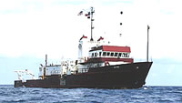
 Gyre |
| Title | Survey Equipment | Description |
|---|---|---|
| Cruise log | (document not focused on specific equipment) | Handwritten cruise log describing ship movement, core and sample collection (including locations), processing, and sample descriptions. |
| Samples log | (document not focused on specific equipment) | Report contains bottom sample descriptions from Smith-McIntyre grab; box, piston, and gravity coring devices; URI rocking chair; and rake-type clam dredges. Also contains dredge trackmap, paleontologist's report, and freshened water/salinity readings with positions. |
| Survey Equipment | Survey Info | Data Type(s) | Data Collected |
|---|---|---|---|
| 3.5 kHz | --- | Sub Bottom Profiler | |
| Sparker | --- | Sparker | |
| Dredge | --- | Biology Geology | |
| Grab sampler | --- | Biology Geology | |
| Rotary core | --- | Geology | |
| Smith-MacIntyre grab | --- | Biology Geology | 1980-014-FA-NL-001-02 (Report contains bottom sample descriptions from Smith-McIntyre grab; box, piston, and gravity coring devices; URI rocking chair; and rake-type clam dredges. Also contains dredge trackmap, paleontologist's report, and freshened water/salinity readings with positions.) |
| Box corer | --- | Biology Geology | |
| Loran-C | --- | Navigation | 1980-014-FA-LN-002 (Digital tape(s) of NV-FINAL, ) 1980-014-FA-LN-001 (Navigation trackline plot for field activity 80014) |
| Single channel hydrophone | --- | Air Gun / Water Gun Boomer Bubble Gun Sparker Sub Bottom Profiler | 1980-014-FA-SE-001 (analog tape of seismic data) |
| Piston corer | --- | Geology |