Other ID: EN-056
Status: Completed
Organization(s): USGS, Woods Hole Coastal and Marine Science Center
Funding Program(s):
Principal Investigator(s): James S. Booth
Affiliate Investigator(s):
Information Specialist(s):
Data Type(s): Biological Field Study: Experiments (biological), Location-Elevation: Navigation, Seismics: Sub Bottom Profiler, Sonar: Single Beam, Sampling: Geology
Scientific Purpose/Goals: Collect piston and gravity cores for environmental and hazards analyses of the Georges Bank and Baltimore Canyon slope and rise areas.
Vehicle(s):
Start Port/Location: Narragansett, RI
End Port/Location: Narragansett, RI
Start Date: 1980-09-24
End Date: 1980-10-16
Equipment Used: Piston corer, Gravity corer, 3.5 kHz, Loran-C, Echosounder
Information to be Derived: Samples and chemical analysis;
Summary of Activity and Data Gathered: This cruise report included two legs: Georges Bank, departing Narragansett, RI on 09/24/1980 and returning to Woods Hole, MA, and Baltimore Canyon, departing Woods Hole, MA on 10/02/1980 and returning to Narragansett, RI. Gravity cores: 26; Piston cores: 28.
Staff: James S. Booth, Paul Bowker, Kathryn Scanlon Catanach, Wayne Ferrebee, Dorothy Marks, Lawrence Poppe, Richard Rendigs
Affiliate Staff:
GEORGES BANK LEG - 09/24/1980: Richard Farrow
USGS-Corpus Christi; Thomas Rice
USGS-Corpus Christi; Ronald Circe
USGS-Corpus Christi; Terry Lerch
USGS-Reston; Dennis Ligon
USGS-Reston; Skip Pelletier
WHOI
Woods Hole; Harold Garbeil
WHOI
Woods Hole; David Walsh
URI
Narragansett Bay; Wayne Fissett
URI
Narragansett Bay; Steve Imms
URI
Narragansett Bay; BALTIMORE CANYON LEG - 10/02/1980; Richard Farrow
USGS-Corpus Christi; Thomas Rice
USGS-Corpus Christi; Bonnie McGregor
USGS-Fisher Island; Ronald Circe
USGS-Corpus Christi; David Schultz
USGS-Reston; Sara Eisner
USGS-Reston; Richard von Herzen
WHOI
Woods Hole; Skip Pelletier
WHOI
Woods Hole; David Walsh
URI
Narragansett Bay; Wayne Fissett
URI
Narragansett Bay; Steve Imms
URI
Narragansett Bay
Notes: Original Center People field contained: GEORGES BANK LEG - 09/24/1980: Jim Booth, Dorothy Marks, Lawrence Poppe, Wayne Ferrebee, Kathy Scanlon, Richard Rendigs; BALTIMORE CANYON LEG - 10/02/1980: Jim Booth, Lawrence Poppe, Wayne Ferrebee, Richard Rendigs, Paul Bowker.
Location:
Georges Bank and Baltimore Canyon OCS lease areas, Wilmington Canyon, United States, North America, North Atlantic;
| Boundaries | |||
|---|---|---|---|
| North: 40.35 | South: 38.61667 | West: -73.0167 | East: -67.28333 |
Platform(s):
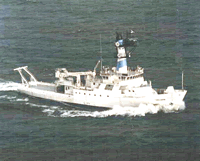 Endeavor |
Booth, J.S., Circe', R.C., and Dahl, A.G., 1984, Geotechnical characterization and mass-movement potential of the United States North Atlantic continental slope and rise: U.S. Geological Survey Open-File Report 85-123, https://doi.org/10.3133/ofr85123.
McGregor, B.A., 1982, 3.5-kHz data collected in the Wilmington Canyon area during 1980, Endeavor cruise 80-EN-056: U.S. Geological Survey Open-File Report 82-498, 5 p., https://doi.org/10.3133/ofr82498.
Poppe, L.J., 1984, X-ray mineralogy of cores from the North Atlantic and Mid-Atlantic continental slope and rise: U.S. Geological Survey Open-File Report 84-673, https://doi.org/10.3133/ofr84673.
| Title | Survey Equipment | Description |
|---|---|---|
| Cruise report | (document not focused on specific equipment) | Chief Scientist's cruise report including personnel list, equipment, station locations including core recovery length. |
| Survey Equipment | Survey Info | Data Type(s) | Data Collected |
|---|---|---|---|
| Piston corer | --- | Geology | |
| Gravity corer | --- | Geology | |
| 3.5 kHz | --- | Sub Bottom Profiler | 1980-027-FA-SE-001 ( Collection of paper record displays of seismic data( 3.5K) for lines ) 1980-027-FA-SE-002 (microfilm of ) |
| Loran-C | --- | Navigation | 1980-027-FA-LN-001 (Navigation trackline plot for field activity 80027) 1980-027-FA-LN-002 (Digital tape(s) of BT, NV-NSTAR, NV,BT, NV-NSTAR-FINAL, ) |
| Echosounder | --- | Single Beam | 1980-027-FA-BA-001 (Digital tape(s) of BT, NV-NSTAR, NV,BT, NV-NSTAR-FINAL, ) |
