Other ID: ESTW 80-8
Status: Completed
Organization(s): USGS, Woods Hole Coastal and Marine Science Center
Funding Program(s):
Principal Investigator(s): Kathleen Kent
Affiliate Investigator(s):
Information Specialist(s):
Data Type(s): Seismics: Air Gun / Water Gun, Seismics: Sparker, Seismics: Sub Bottom Profiler, Sonar: Single Beam, Electro-Magnetic: Magnetics, Seismics: Boomer, Seismics: Bubble Gun, Location-Elevation: Navigation
Scientific Purpose/Goals: Act as escort vessel during ALVIN/LULU operations. Study the morphology and map previously identified features at the top and base of the Blake Escarpment using seismic reflection profiles acquired within 30 mi. of the dive sites. Acquire marine magnetics data in the Blake Bahama Basin.
Vehicle(s):
Start Port/Location: Beaufort, NC
End Port/Location: Beaufort, NC
Start Date: 1980-10-18
End Date: 1980-11-02
Equipment Used: Air gun, Teledyne single-channel 300-500J 40-tip minisparker, 3.5 kHz, 12 kHz, Geometrics G-856 magnetometer, Teledyne 28420 hydrophone, Northstar 6000 LORAN-C
Information to be Derived: Sea floor map;
Summary of Activity and Data Gathered: Overall data quality is good, acquiring one second penetration with the sparker and greater than 2 seconds penetration with the airgun. The data indicate that the Blake Escarpment is an extremely steep slope. Because of the steep slope reflections from the surface of the escarpment are usually lost, or obscured by diffractions and side echoes. Reflectors in the Blake Bahama Basin are continuous and nearly parallel, sometimes onlapping a variable size erosional bench at the base of the Blake Escarpment. The character of reflectors on the Blake Plateau is variable suggesting alternate periods of erosion, deposition and reef growth. 1800 km airgun data; 1930 km sparker data; 1885 km magnetics data; 2080 km 3.5 kHz data; 1360 km 12 kHz data.
Staff: Dann Blackwood, Joseph S. Newell, Janet B. Burke, Elizabeth Coward, Kathleen Kent, Barbara Ann McKinney
Affiliate Staff:
Lewis Gilbert; Greg Miller
Oceanographic party chief
Duke University
Beaufort; Clyde Buchanin
Marine Environmental Services
Ridgewood
NJ
Notes: Original Center People field contained: Kathleen Kent, Chief Scientist; Janet Burke, Cruise Curator; Lewis Gilbert; Ann Swift; Dann Blackwood; Betsy Coward; Joseph Newell.
Location:
Blake Escarpment, United States, North America, North Atlantic;
| Boundaries | |||
|---|---|---|---|
| North: 31 | South: 28.2 | West: -77 | East: -76 |
Platform(s):
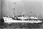 Eastward |
| Survey Equipment | Survey Info | Data Type(s) | Data Collected |
|---|---|---|---|
| Air gun | --- | Air Gun / Water Gun | |
| Teledyne single-channel 300-500J 40-tip minisparker | --- | Sparker | |
| 3.5 kHz | --- | Sub Bottom Profiler | |
| 12 kHz | --- | Single Beam | |
| Geometrics G-856 magnetometer | --- | Magnetics | |
| Teledyne 28420 hydrophone | --- | Air Gun / Water Gun Boomer Bubble Gun Sparker Sub Bottom Profiler | 1980-029-FA-SE-001 ( Collection of paper record displays of seismic data( MSP) for lines ) 1980-029-FA-SE-002 (microfilm of ) 1980-029-FA-SE-003 (analog tape of seismic data) |
| Northstar 6000 LORAN-C | --- | Navigation | 1980-029-FA-LN-002 (Digital tape(s) of NV, NV-SAT FIX, ) 1980-029-FA-LN-001 (Navigation trackline plot for field activity 80029) 1980-029-FA-LN-003 (Digital tapes of NV, NV-NSTAR, and NV-NSTAR-FINAL: inventory #1107, 1342, 1344, 2816, and 3718.) |
