Other ID: 81-G-7-1
Status: Completed
Organization(s): USGS, Woods Hole Coastal and Marine Science Center
Funding Program(s):
Principal Investigator(s): E. Ann Martin
Affiliate Investigator(s):
Information Specialist(s):
Data Type(s): Sampling: Biology, Sampling: Geology, Biological Field Study: Experiments (biological), Environmental Data: Current, Location-Elevation: Navigation
Scientific Purpose/Goals: Collect box and piston cores from 3 intraslope basins and from an area of the Mississippi Delta. Samples to be analyzed for geochemicals, texture and geotechnical parameters.
Vehicle(s):
Start Port/Location: Galveston, TX
End Port/Location: Venice, LA
Start Date: 1981-05-01
End Date: 1981-05-09
Equipment Used: Piston corer, Box corer, Dredge, Current Drift Bottle, Integrated Navigation System
Information to be Derived:
Summary of Activity and Data Gathered: 12 kHz bathymetry data: 10 nm (18.5 km); 3.5 kHz seismic reflection data: 50 nm (92.6 km); Box cores: 11; Piston cores: 10; Dredge: 1; Drift bottles deployed: 24.
Staff: Barry Irwin, Lawrence Poppe, Raymond E. Hall
Affiliate Staff:
USGS-Corpus Christi: Jack Kindinger - Co-Ch. Sci.
Ann Martin - Co-Ch. Sci.
Chuck Stelting - Phy. Sci. Tech.
Cyndi Rice - Oceano.
Neal Lillard - Watch
George Harrison - Oceano.
Ron Circe - Phy. Sci.
Martha Van der Werken - Phy. Sci. Tech.
Jim Ray - Watch
John Benton - Phy. Sci. Asst.; USGS-Denver: Hal Olsen - Eng. Branch; WHOI: Beecher Wooding - Phy. Sci. Tech.
Notes: Original Center People field contained: Lawrence Poppe - Geol., Ray Hall - Geol., Barry Irwin - Nav.
Project = Continental Slope studies, Mississippi Delta; Deep Sea Basins, Continental Slope studies, Mississippi Delta; Deep Sea Basins
Information from Foghorn: box corer, piston corer, dredge, drift bottles;
Location:
intraslope basins, Carancahua Basin, Gyre Basin, Orca Basin, Mississippi Delta, Gulf of Mexico, United States, North America, North Atlantic;
| Boundaries | |||
|---|---|---|---|
| North: 27.5 | South: 26.5 | West: -91 | East: -90 |
Platform(s):
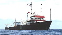
 Gyre |
Poppe, L.J., and Circe', R.C., 1983, Hoffa Reef—A shelf-edge calcareous prominence in the northern Gulf of Mexico: U.S. Geological Survey Open-File Report 83-745, https://doi.org/10.3133/ofr83745.
| Title | Survey Equipment | Description |
|---|---|---|
| Cruise report | (document not focused on specific equipment) | Brief chief scientist's cruise report including personnel list, equipment and a few comments. Also contains the NOAA general cruise inventory sheets. |
| Survey Equipment | Survey Info | Data Type(s) | Data Collected |
|---|---|---|---|
| Piston corer | --- | Geology | |
| Box corer | --- | Biology Geology | |
| Dredge | --- | Biology Geology | |
| Current Drift Bottle | --- | Current | |
| Integrated Navigation System | --- | Navigation | 1981-010-FA-LN-001 (Digital tape(s) of NV-INS, NV,GR-SAT, ) |