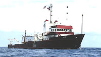
Other ID: GYRE-81-14, Leg 1
Status: Completed
Organization(s): USGS, Woods Hole Coastal and Marine Science Center
Funding Program(s):
Principal Investigator(s): Deborah Hutchinson, John Grow
Affiliate Investigator(s):
Information Specialist(s):
Data Type(s): Seismics: Multichannel, Electro-Magnetic: Magnetics, Sonar: Single Beam, Seismics: Sonobuoy, Electro-Magnetic: Gravity, Sampling: Biology, Sampling: Geology, Location-Elevation: Navigation
Scientific Purpose/Goals: Define the extent and size of rift valleys identified in the basement surface of the LI Platform from USGS lines 24, 9, and 36 using the high-resolution multichannel system. Collect refraction velocity measurements within the rift structures and along undisturbed basement using the USGS OBIPs. Collect gravity data in the NY Bight, Raritan Bay, and NY Harbor to better define the shape and magnitude of the offshore extent of the Piedmont gravity high. Define the shape of the northern edge of the Baltimore Canyon Trough where it meets the LI Platform. Collect refraction velocity measurements along USGS Line 34 (continental slope) for a proposed ocean margin drill site. Test the resolution of the 240 m (12 channel) streamer with the 80 in3 watergun compared to the 120 m (12 channel) streamer and 15 in3 watergun. Do signature tests for the 540 in3 airgun, the 80 in3 watergun, the 40 in3 airgun, and the 15 in3 watergun.
Vehicle(s):
Start Port/Location: Woods Hole, MA
End Port/Location: Atlantic City, NJ
Start Date: 1981-09-15
End Date: 1981-09-26
Equipment Used: Multichannel seismics, Marine magnetometer, Echosounder, Seismic refraction, Bell Aerospace BGM-3 gravimeter, Gravity corer, Grab sampler, Northstar 6000 LORAN-C
Information to be Derived:
Summary of Activity and Data Gathered: Magnetic data: 15 km; Gravity data: 810 km (31 lines, 6 profiles); Seismic reflection data: 15 km of 12-channel, 247 km of 6-channel and 279 km of single-channel; Echo sounding data: 810 km of 3.5-kHz; Refraction profiles: 20 km of watergun and 94 km of airgun; Samples: 1 core and 3 grabs; OBIPs deployed: 13; OBIPs recovered: 12; Sonobuoys deployed: 4.
Staff: Raymond E. Davis, Deborah Hutchinson, Barry Irwin, Barbara Ann McKinney, David Nichols, Kathryn Scanlon Catanach, John Grow, Bruce Ambuter, Robert F. Commeau, Richard A. Wise, James E. Dodd, Quad Wheeler, Elizabeth Coward, Jack Connell
Affiliate Staff:
September 15-26
1981: Robin Bell - Nav./Seismic watch
John Godley - OBIPs
Tom O'Brien - DFS V Tech. (WHOI); September 15-21
1981: Larry Lowe - Watergun Tech.
Jim McCullough - LORAN-C (WHOI)
Ed Harper - OBIPS (Benthos)
Notes: Original Center People field contained: September 15-26, 1981: John Grow - Co-Chief Scientist, Debbie Hutchinson - Co-Chief Scientist, Jim Dodd - Nav. watch, Barry Irwin - Nav. watch, Robin Bell - Nav./Seismic watch, Betsy Coward - Nav./Seismic watch, Ann Swift - Seismic watch, Bob Commeau - Seismic watch, Quad Wheeler - Seismic watch, Kathy Scanlon - Corring Tech., John Godley - OBIPs; September 15-21, 1981: Dave Nichols - DFS V Tech., Dick Wise - DFS V Tech., Larry Lowe - Watergun Tech.; September 21-26, 1981: Bruce Ambuter - OBIPs, Ray Davis - OBIPs, Jack Connell - DFS V Tech.
Project = Mid-Atlantic, Mid-Atlantic
Location:
Long Island Platform, New York, Connecticut, United States, North America, North Atlantic;
| Boundaries | |||
|---|---|---|---|
| North: 40.93333 | South: 39.1 | West: -74 | East: -71.71667 |
Platform(s):
 Gyre |
| Title | Survey Equipment | Description |
|---|---|---|
| Cruise report | (document not focused on specific equipment) | Chief Scientist's cruise report including personnel, cruise objectives, equipment and acquistion parameters, daily log of work, and cruise narrative. Tables of data acquisition, trackmap, and seismic profile example. |
| Survey Equipment | Survey Info | Data Type(s) | Data Collected |
|---|---|---|---|
| Multichannel seismics | --- | Multichannel | 1981-033-FA-SE-002 (microfilm of ) 1981-033-FA-SE-003-01 (Seismic data recorded from 9 track tape) 1981-033-FA-SE-003 (Digital tape(s) of NV-INS, GR, GR-UNEDIT, GR-EDIT,UNEDIT, NV-EDIT, NV-UNEDIT, GR-BELL, NV-FINAL, GR-L&R, NV,GR,VN,VE,RWG, NV-INS-FINAL, OBIP, GRV, ) 1981-033-FA-SE-001 ( Collection of paper record displays of seismic data( AIR) for lines ) |
| Marine magnetometer | --- | Magnetics | 1981-033-FA-GP-002 (Digital tape(s) of NV-INS, GR, GR-UNEDIT, GR-EDIT,UNEDIT, NV-EDIT, NV-UNEDIT, GR-BELL, NV-FINAL, GR-L&R, NV,GR,VN,VE,RWG, NV-INS-FINAL, OBIP, GRV, ) |
| Echosounder | --- | Single Beam | |
| Seismic refraction | --- | Sonobuoy | |
| Bell Aerospace BGM-3 gravimeter | --- | Gravity | 1981-033-FA-GP-001 (Digital tape(s) of NV-INS, GR, GR-UNEDIT, GR-EDIT,UNEDIT, NV-EDIT, NV-UNEDIT, GR-BELL, NV-FINAL, GR-L&R, NV,GR,VN,VE,RWG, NV-INS-FINAL, OBIP, GRV, ) |
| Gravity corer | --- | Geology | |
| Grab sampler | --- | Biology Geology | |
| Northstar 6000 LORAN-C | --- | Navigation | 1981-033-FA-LN-001 (Navigation trackline plot for field activity 81033) 1981-033-FA-LN-002 (Digital tape(s) of NV-INS, GR, GR-UNEDIT, GR-EDIT,UNEDIT, NV-EDIT, NV-UNEDIT, GR-BELL, NV-FINAL, GR-L&R, NV,GR,VN,VE,RWG, NV-INS-FINAL, OBIP, GRV, ) |