Other ID: 81-15
Status: Completed
Organization(s): USGS, Woods Hole Coastal and Marine Science Center
Funding Program(s):
Principal Investigator(s): John C. Behrendt
Affiliate Investigator(s):
Information Specialist(s):
Data Type(s): Electro-Magnetic: Gravity, Location-Elevation: Navigation, Seismics: Multichannel, Seismics: Boomer
Scientific Purpose/Goals: Collect high-resolution multichannel seismic and other geophysical data in shallow water related to a study of the Charleston, SC earthquake.
Vehicle(s):
Start Port/Location: Charleston, SC
End Port/Location: Charleston, SC
Start Date: 1981-10-03
End Date: 1981-10-09
Equipment Used: Loran-C, Seismic reflection, Gravity meter (wh), Multichannel seismics
Information to be Derived:
Summary of Activity and Data Gathered: Multichannel Lines: G1-G29.
Staff: John C. Behrendt, Robert F. Commeau, Elizabeth Coward, James E. Dodd, Muriel Grim, Barry Irwin, David Mason, Gregory Miller, David Nichols, George B. Tirey, S. Jeffress Williams
Affiliate Staff:
R. Hamilton - Geophysicist; R. Bell - Technician; N. Zihlman - Technician; Tom O'Brien - Geophysicist
WHOI; K. Wetzel - Reporter
freelance
Notes: Original Center People field contained: John Behrendt - Chief Scientist, Geophysicist; R. Hamilton - Geophysicist; M. Grim - Geophysicist; Dave Nichols - Technician; J. Williams - Technician; R. Bell - Technician; B. Coward - Geologist; J. Dodd - Engineer; Barry Irwin - Physical Scientist; Greg Miller - Physical Scientist; N. Zihlman - Technician; Rusty Tirey - Engineer; Dave Mason - Technician; Robert Commeau - Geologist.
Project = Charleston Earthquake Research, Charleston Earthquake Research
Location:
offshore Charleston, South Carolina, United States, North America, North Atlantic;
| Boundaries | |||
|---|---|---|---|
| North: 32.8 | South: 32.5 | West: -80 | East: -79.7 |
Platform(s):
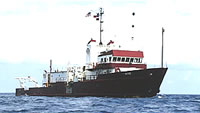
 Gyre |
| Survey Equipment | Survey Info | Data Type(s) | Data Collected |
|---|---|---|---|
| Loran-C | --- | Navigation | 1981-036-FA-LN-001 (Navigation trackline plot for field activity 81036) 1981-036-FA-LN-002 (Digital tape(s) of NV-INS, NV-EDIT, PROCESSED GRAV, ) |
| Seismic reflection | --- | Air Gun / Water Gun Boomer Sparker | |
| Gravity meter (wh) | --- | Gravity | 1981-036-FA-GP-001 (Digital tape(s) of NV-INS, NV-EDIT, PROCESSED GRAV, ) |
| Multichannel seismics | --- | Multichannel | 1981-036-FA-SE-001-01 (Seismic data recovered from 9 track tapes) |