Other ID: AST 83-03
Status: Completed
Organization(s): USGS, Woods Hole Coastal and Marine Science Center
Funding Program(s):
Principal Investigator(s): Kathryn Scanlon Catanach, Harley J. Knebel
Affiliate Investigator(s):
Information Specialist(s):
Data Type(s): Location-Elevation: Navigation, Seismics: Boomer, Sonar: Sidescan
Scientific Purpose/Goals: To define the geologic and geophysical characteristics of the bottom and sub-bottom sediments of Penobscot Bay.
Vehicle(s):
Start Port/Location: Woods Hole, MA
End Port/Location: Woods Hole, MA
Start Date: 1983-06-09
End Date: 1983-06-19
Equipment Used: EG&G 234, Edo Western Sidescan and 2.5 kHz sub-bottom system, Northstar 6000 LORAN-C, Single channel hydrophone
Information to be Derived:
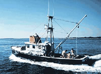
Summary of Activity and Data Gathered: R/V ASTERIAS left Woods Hole for Camden, ME on 9 June 1983 with Capt. Colburn onboard. Greg Miller, Harley Knebel, and Kathy Scanlon drove to Camden on 10 June, meeting ASTERIAS at Willey's Wharf in the evening. We began surveying with the EG&G Uniboom seismic profiling system on the morning of 11 June and continued each day through 17 June. On 13 June we began running the EDO sidescan sonar system on selected lines. On the evening of 14 June, Harley Knebel got off ASTERIAS, turning the Chief Scientist's duties over to Kathy Scanlon, and Dave Nichols joined us. LORAN-C time delays received by a Northstar 6000 unit and printed out and taped by a TI Silent 700 were used as the primary means of navigation. Capt. Colburn made frequent checks on our position using radar "distances off" and navigational buoys. After the cruise, the LORAN-C time delays that were recorded by the Northstar unit were calibrated by Barry Irwin against positions from the NOS chart of the bay; appropriate ASF corrections were applied to the recorded time delays. Equipment malfunctions were few and of short duration. The Uniboom and sidescan data were recorded on paper by flatbed recorders. All of the Uniboom data (except for 5 hours on 13 June) were also recorded on analog tape. We spent the nights of June 10, 12, 14, 16, and 17 tied up at Willey's Wharf in Camden, ME. The nights of June 11, 13, and 15 we anchored in convenient coves. On 18 June, Greg Miller and Kathy Scanlon drove from Camden to Woods Hole, while Capt. Colburn and Dave Nichols set out in ASTERIAS. They arrived in Woods Hole on the morning of 19 June. 243 km of Uniboom (high-resolution seismic reflection) and 71 km of sidescan sonar data collected.
Staff: Kathryn Scanlon Catanach, Harley J. Knebel, Gregory Miller, David Nichols
Affiliate Staff:
Notes: Original Center People field contained: Harley Knebel - Ch. Sci. (11-14 June); Greg Miller - technician (11-17 June); Dave Nichols - technician (15-19 June); Kathy Scanlon - geologist (11-14 June), Ch. Sci. (15-17 June).
Project = Coastal, Estuarine, and Lacustrine Studies, Coastal, Estuarine, and Lacustrine Studies
Location:
Penobscot Bay, Maine, United States, North America, North Atlantic;
| Boundaries | |||
|---|---|---|---|
| North: 44.5 | South: 43.33333 | West: -69.0833 | East: -68.66667 |
Platform(s):
 Asterias |
| Title | Survey Equipment | Description |
|---|---|---|
| Data inventory | (document not focused on specific equipment) | Cruise Curator's Inventory Logbook: Handwritten logbook including seismic analog record inventory, Loran C navigation sheets inventory, Loran C navigation cassette inventory, and analog magtape inventory. |
| Navigation log | Northstar 6000 LORAN-C | USGS Integrated Navigation System and Northstar Loran-C Navigation Log: Handwritten notes including date, time, line #, ship course, latitude, longitude, data quality, and comments. |
| Cruise report | (document not focused on specific equipment) | Chief Scientist's cruise report including personnel, project description, tabulation of data collected and a trackmap. |
| Survey Equipment | Survey Info | Data Type(s) | Data Collected |
|---|---|---|---|
| EG&G 234 | --- | Boomer | |
| Edo Western Sidescan and 2.5 kHz sub-bottom system | --- | Sub Bottom Profiler Sidescan | 1983-003-FA-SO-001 (microfilm of ) |
| Northstar 6000 LORAN-C | --- | Navigation | 1983-003-FA-LN-001 (Navigation Data: NSTAR 1 format, recovered from 9-track tape. Original Tape #2759, discarded.) 1983-003-FA-LN-003 (Navigation trackline plot for field activity 83003) 1983-003-FA-LN-004 (Digital tape(s) of NV, NV-NSTAR, ) 1983-003-FA-LN-002 (Trackcharts: cruise trackcharts with day, hour and 5-minute ticks. 1 p.; WHSC Data Library Inventory #TK00721.) |
| Single channel hydrophone | --- | Air Gun / Water Gun Boomer Bubble Gun Sparker Sub Bottom Profiler | 1983-003-FA-SE-002 ( Collection of paper record displays of seismic data( UNI) for lines ) 1983-003-FA-SE-004 (analog tape of seismic data) 1983-003-FA-SE-001-01 (Cropped seismic profiles: 47 cropped record sections for 45 seismic profiles, identified by line number, in tif format.) 1983-003-FA-SE-001-02 (Scanned Profiles - (tif files) 47 scanned record sections in TIFF format.) 1983-003-FA-SE-003 (microfilm of ) |