Other ID: LYNCH 702-84/II
Status: Completed
Organization(s): USGS, Woods Hole Coastal and Marine Science Center
Funding Program(s):
Principal Investigator(s): Charles W. Holmes
Affiliate Investigator(s):
Information Specialist(s):
Data Type(s): Seismics: Sparker, Seismics: Sub Bottom Profiler, Imagery: Photo, Location-Elevation: Navigation
Scientific Purpose/Goals: Obtain high-resolution (700 J) sub-bottom data in the Florida Straits to complete mapping the sedimentary sequences discovered on previous cruises; and obtain sample outcrops of sequences that outcrop in the Florida Canyon.
Vehicle(s):
Start Port/Location: Tampa, FL
End Port/Location: Ft. Lauderdale, FL
Start Date: 1983-11-09
End Date: 1983-11-22
Equipment Used: Teledyne single-channel 300-500J 40-tip minisparker, Single channel hydrophone, Del Norte 26 sparker, ORE 140 transceiver/1036 transducer sub-bottom profiler, Benthos model 372 camera and strobe, Loran-C
Information to be Derived: Sea floor map; Morphology; Samples and chemical analysis;
Summary of Activity and Data Gathered: Camera was lost on the first cast due to a break in the wire on the drum. 30,000 J Sparker data: 1520 km; 3.5 kHz ORE data: 1750 km; Cores: 10 (avg. 2.5 m); Dredges: 3; Minisparker data: 1520 km.
Staff: Nancy Hardin, Charles W. Holmes, James Ray, John West
Affiliate Staff:
Walter Bowles; Jennifer Walker; Linda Massingill - MMS; Greg Brooks - USF; Steve Walker - USF
Notes: Original Center People field contained: Chuck Holmes, Chief Scientist; Jack Kindinger; Nancy Hardin; John West; James Ray; Walter Bowles; Jennifer Walker.
Project = West Florida Shelf, West Florida Shelf
Location:
Florida Straits, Florida, United States, Gulf of Mexico, North America, North Atlantic;
| Boundaries | |||
|---|---|---|---|
| North: 25 | South: 23.7 | West: -84.8 | East: -81.2 |
Platform(s):
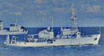 Lynch |
| Title | Survey Equipment | Description |
|---|---|---|
| Cruise report | (document not focused on specific equipment) | Brief Chief Scientist's cruise report including personnel, purpose, equipment, and short summary of data collected. |
| Survey Equipment | Survey Info | Data Type(s) | Data Collected |
|---|---|---|---|
| Teledyne single-channel 300-500J 40-tip minisparker | --- | Sparker | |
| Single channel hydrophone | --- | Air Gun / Water Gun Boomer Bubble Gun Sparker Sub Bottom Profiler | 1983-014-FA-SE-001 (microfilm of) |
| Del Norte 26 sparker | --- | Sparker | |
| ORE 140 transceiver/1036 transducer sub-bottom profiler | --- | Sub Bottom Profiler | |
| Benthos model 372 camera and strobe | --- | Photo | |
| Loran-C | --- | Navigation | 1983-014-FA-LN-001 (Cruise trackmap for LYNCH 702-84-II.) |
