Other ID: none
Status: Completed
Organization(s): USGS, Woods Hole Coastal and Marine Science Center
Funding Program(s):
Principal Investigator(s): Page Valentine
Affiliate Investigator(s):
Information Specialist(s):
Data Type(s): Sampling: Biology, Sampling: Geology
Scientific Purpose/Goals:
Vehicle(s):
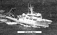
Start Port/Location: Woods Hole, MA
End Port/Location: Woods Hole, MA
Start Date: 1983-07-19
End Date: 1983-07-30
Equipment Used: Grab sampler
Information to be Derived: Grain size analysis; Habitat maps;
Summary of Activity and Data Gathered: Van Veen samples: 22; Push cores: 104.
Staff: Page Valentine
Affiliate Staff:
Notes: Created from Aldrich cruise calendar.
Location:
Georges Bank, Lydonia Canyon, Oceanographer Canyon, Veatch Canyon, United States, North America, North Atlantic;
| Boundaries | |||
|---|---|---|---|
| North: 43.61398407 | South: 40.1714109 | West: -68.73530436 | East: -65.67889976 |
Platform(s):
 Johnson | 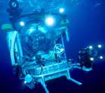 Johnson Sea-link |
| Survey Equipment | Survey Info | Data Type(s) | Data Collected |
|---|---|---|---|
| Grab sampler | --- | Biology Geology | 1983-021-FA-SC-001 (GRAB, SUBMERSIBLE SAMPLE samples) |
