Other ID: J-163 (Leg IV)
Status: Completed
Organization(s): USGS, Woods Hole Coastal and Marine Science Center
Funding Program(s):
Principal Investigator(s): David Twichell
Affiliate Investigator(s): Dr. Robert S. Jones (HBF); Dr. Churchill B. Grimes (Rutgers)
Information Specialist(s):
Data Type(s): Environmental Data: CTD, Imagery: Photo, Imagery: Video, Location-Elevation: Navigation, Sampling: Biology, Sampling: Geology, Seismics: Sub Bottom Profiler, Sonar: Sidescan
Scientific Purpose/Goals: 1) Test our hypothesis that rough bottom topography in the Mid-Atlantic Bight resulted from bioerosion by the tilefish community, and 2) further develop the use of sidescan sonar and sub-bottom profiling as a tool for assessing critical habitat for fishery resources.
Vehicle(s):
Start Port/Location:
End Port/Location:
Start Date: 1984-07-28
End Date: 1984-08-04
Equipment Used: Submersible, Video camera - deep sea, Camera- deep sea, Loran-C, Sidescan sonar, CTD 19+ with OBS, PAR, DO, Chl, 3.5 kHz
Information to be Derived:
Summary of Activity and Data Gathered: Optimal weather conditions allowed us to conduct a variety of submersible, sidescan sonar and sub-bottom profiling operations in the Middle Ground area between Block and Atlantis submarine canyons. Overall, we successfully completed 13 submersible dives and made numerous transects for sidescan sonar. Sidescan Sonar: 129.64 km; Sub-bottom profiling: 290.39; Sediment samples: 26; video and photos.
Staff: David Twichell
Affiliate Staff:
Dr. Robert S. Jones - co-Ch. Sci. (HBF); Dr. Churchill B. Grimes - co-Ch. Sci. (Rutgers); Dr. Kenneth W. Able - scientist (Rutgers); Dr. Edward P. Laine - scientist (URI); Mr. Gregory C. Kennedy - engineer (HBF); Mr. Simon Sainsbury - engineer (HBF)
Notes: Original Center People field contained: Dave Twichell - scientist.
Location:
Middle Grounds area, Block Canyon, Atlantis Canyon, Veatch Canyon, mid-Atlantic Bight, North America, North Atlantic;
| Boundaries | |||
|---|---|---|---|
| North: 40.5 | South: 39.83333 | West: -71.5 | East: -69.5 |
Platform(s):
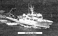 Johnson | 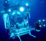 Johnson Sea-link |
Able, K.W., Grimes, C.B., Jones, R.S., Twichell, D.C., 1993, Temporal and spatial variation in habitat characteristics of tilefish (Lopholatilus Chamaeleonticeps) off the east coast of Florida: Bulletin of Marine Science, v. 53, pp. 1013–1026(14), URL: https://www.ingentaconnect.com/content/umrsmas/bullmar/1993/00000053/00000003/art00005.
Able, K.W., Twichell, D.C., Grimes, C.B., Jones, R.S., 1987, Sidescan sonar as a tool for detection of Demersal fish habitats: Fishery Bulletin, v. 85 no. 4, URL: https://pubs.er.usgs.gov/publication/70137344.
Twichell, D.C., Grimes, C. B., Jones, R. S., and Able, K. W., 1984, The role of bioerosion in shaping the outer continental shelf around Hudson Canyon, offshore Eastern United States [abs.]: , Geological Society of America, Northeastern Section, 19th Annual Meeting, Abstracts with Programs. Providence, R.I., 15-17 March 1984.
Twichell, D.C., Jones, R. S., Grimes, C. B., Able, K. W., Anonymous,, 1984, Bioerosion; its importance in shaping the outer continental shelf around Hudson Canyon off the eastern United States [abs.]: , Symposia Series for Undersea Research, NOAA National Undersea Research Conference; Undersea research and technology, scientific applications and future needs, Abstracts. Groton, Conn., 22-24 May 1984.
| Title | Survey Equipment | Description |
|---|---|---|
| Cruise report | (document not focused on specific equipment) | Chief Scientist's report including personnel, results narrative, and tabulated summary of submersible operations. Also includes maps of submersible work. |
| Survey Equipment | Survey Info | Data Type(s) | Data Collected |
|---|---|---|---|
| Submersible | --- | Photo Video Biology Chemistry Geology | |
| Video camera - deep sea | --- | Video | |
| Camera- deep sea | --- | Photo | |
| Loran-C | --- | Navigation | 1984-009-FA-LN-001-01 (Track maps of geophysical survey areas and submersible dives, plotted from ship navigation with MapGen software, in Lat./Long.: UTM projection, 1:25,000 scale, 2 maps for each of 5 areas.) 1984-009-FA-LN-002 (Paper charts from bridge plotter of sidescan sonar and 3.5 kHz survey lines and submersible dives; Loran-C coordinates.) 1984-009-FA-LN-001 (Paper printouts of navigation with 15 minute or random fix intervals: includes time, lat., long., speed and course over ground.) |
| Sidescan sonar | --- | Sidescan | 1984-009-FA-SO-001 (Paper sidescan sonar profiles in folders; images not slant-range or ground-range corrected.) |
| CTD 19+ with OBS, PAR, DO, Chl | --- | CTD | 1984-009-FA-OM-001 (Digital tape(s) of CTD STATION DATA, ) |
| 3.5 kHz | --- | Sub Bottom Profiler | 1984-009-FA-SE-001 (Paper 3.5 kHz seismic profiles in folders: collected via EPC recorder.) |
