Other ID: none
Status: Completed
Organization(s): USGS, Woods Hole Coastal and Marine Science Center
Funding Program(s):
Principal Investigator(s): David Twichell
Affiliate Investigator(s): Ken Able, Rutgers Univ.
Information Specialist(s): David Twichell
Data Type(s): Location-Elevation: Navigation, Sonar: Sidescan
Scientific Purpose/Goals: Map tilefish burrows.
Vehicle(s):
Start Port/Location: Indian River, FL
End Port/Location: Indian River, FL
Start Date: 1984-05-19
End Date: 1984-05-21
Equipment Used: Loran-C, Sidescan sonar
Information to be Derived: Habitat maps; Sea floor map;
Summary of Activity and Data Gathered: Sidescan sonar data were collected at the Cape Canaveral shelf edge to map differences in tilefish burrow density with increasing water depth.
Staff: David Twichell
Affiliate Staff:
Ken Able
Rutgers Univ.; Bob Jones
Harbor Branch Foundation
Notes:
Location:
Cape Canaveral, Florida east coast, United States, North Atlantic;
| Boundaries | |||
|---|---|---|---|
| North: 28.8333 | South: 28.7 | West: -80.0666 | East: -79.9333 |
Platform(s):
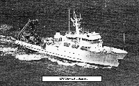 Johnson | 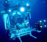 Johnson Sea-link |
| Survey Equipment | Survey Info | Data Type(s) | Data Collected |
|---|---|---|---|
| Loran-C | --- | Navigation | 1984-034-FA-LN-001-01 (Track map of sidescan survey area, plotted from ship navigation with MapGen software, in Lat./Long.) 1984-034-FA-LN-001 (Paper printouts of navigation with 5 minute fix intervals: includes time, lat., long., speed and course over ground.) 1984-034-FA-LN-002 (Paper charts from bridge plotter of sidescan sonar survey lines; Loran-C coordinates.) |
| Sidescan sonar | --- | Sidescan | 1984-034-FA-SO-001 (Paper sidescan sonar profiles in folders; images not slant-range or ground-range corrected.) |
