Other ID: none
Status: Completed
Organization(s): USGS, Woods Hole Coastal and Marine Science Center
Funding Program(s):
Principal Investigator(s): Edward Escowitz
Affiliate Investigator(s):
Information Specialist(s):
Data Type(s): Sampling: Geology, Sampling: Biology, Sonar: Single Beam, Location-Elevation: Navigation, Sonar: Sidescan
Scientific Purpose/Goals: Delineation of placer heavy minerals in a number of study areas. Follow-up sampling of areas previously sampled.
Vehicle(s):
Start Port/Location: Fort Lauderdale, FL
End Port/Location: Alexandria, VA
Start Date: 1985-06-03
End Date: 1985-06-28
Equipment Used: Alpine Vibracorer, Box corer, Grab sampler, Echosounder, Sidescan sonar, Loran-C, Magnavox satellite positioning system
Information to be Derived:
Summary of Activity and Data Gathered: A total of 60 vibracores and 72 grab samples were acquired. The majority of the grab samples were processed at sea using the three-turn spiral to concentrate the heavy minerals. Selected grab samples were examined microscopically to determine the major constituents of the heavy-mineral assemblages present.
Staff: Edward Escowitz
Affiliate Staff:
Andrew Grosz
Ricardo Lopez
Mark Brown
Chris Galagan
Hall Williams
Jack Swenson
L. Kooker
C. Lief
R. Fields
B. Lipin
J. Wynn
Notes: Information derived from pre-cruise report and center quarterly report; no post-cruise report found. Original Center People field contained: Ed Escowitz, Andrew Grosz, Ricardo Lopez, Mark Brown, Chris Galagan, Hall Williams, Jack Swenson, L. Kooker, C. Lief, R. Fields, B. Lipin, J. Wynn.
Location:
Atlantic Continental Shelf, South Atlantic Bight EEZ, Middle Atlantic Bight EEZ, Florida, Georgia, South Carolina, North Carolina, Virginia, Maryland, United States, North America, North Atlantic;
| Boundaries | |||
|---|---|---|---|
| North: 36.87962 | South: 28.53627 | West: -82.1777 | East: -72.94922 |
Platform(s):
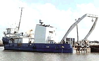
 John Wesley Powell |
| Survey Equipment | Survey Info | Data Type(s) | Data Collected |
|---|---|---|---|
| Alpine Vibracorer | --- | Geology | |
| Box corer | --- | Biology Geology | |
| Grab sampler | --- | Biology Geology | |
| Echosounder | --- | Single Beam | |
| Sidescan sonar | --- | Sidescan | |
| Loran-C | --- | Navigation | |
| Magnavox satellite positioning system | --- | Navigation |