Other ID: DISC-85-2
Status: Completed
Organization(s): USGS, Woods Hole Coastal and Marine Science Center
Funding Program(s):
Principal Investigator(s): Stephen Colman
Affiliate Investigator(s): Jeff Halka - Maryland Geological Survey (MGS)
Information Specialist(s):
Data Type(s): Seismics: Boomer, Seismics: Air Gun / Water Gun, Seismics: Bubble Gun, Seismics: Sparker, Seismics: Sub Bottom Profiler, Sonar: Sidescan, Location-Elevation: Navigation
Scientific Purpose/Goals: Collect high-resolution seismic reflection and sidescan sonar data in order to define the geology and shallow structure of the Chesapeake Bay.
Vehicle(s):
Start Port/Location:
End Port/Location:
Start Date: 1985-09-17
End Date: 1985-09-24
Equipment Used: ORE GeoPulse, Del Norte hydrophone, Datasonics SST 220 sub-bottom 3.5k, EG&G Model SMS 960 Seafloor Mapping System, Northstar 6000 LORAN-C
Information to be Derived:
Summary of Activity and Data Gathered: The cruise was quite successful, despite being cut three days short because of Hurricane Gloria. A total of 280 nm (518 km) of tracklines was covered. Except for the hurricane, weather was excellent with several flat-calm days. The seismic reflection records obtained were very good except in local areas where the sediments contained biogenic gas. Penetration achieved by the seismic signals was mostly 100 msec or more, and the records clearly show the entire Quaternary and upper part of the Tertiary sequence of deposits. Multiple overlapping channels and channel-fill deposits related to major fluctuations in sea level were observed.
Staff: Stephen Colman, Monica Webster, John West
Affiliate Staff:
Jeff Halka
Chief Scientist; Woody Hobbs
VIMS
Notes: Original Center People field contained: Steve Colman, Chief Scientist; Monica Webster, GFA; John West, Technician.
Project = Geology of Chesapeake Bay, Geology of Chesapeake Bay
Location:
central Chesapeake Bay, United States, North America, North Atlantic;
| Boundaries | |||
|---|---|---|---|
| North: 38.18 | South: 37.7 | West: -76.25 | East: -75.6 |
Platform(s):
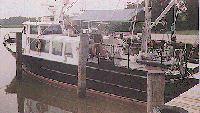 Discovery |
| Title | Survey Equipment | Description |
|---|---|---|
| Cruise report | (document not focused on specific equipment) | Chief Scientist's report including personnel, purpose, equipment used and performance, brief cruise summary and a trackmap. |
| Data inventory | (document not focused on specific equipment) | Inventory of field data by data type, media, and quantity. |
| Survey Equipment | Survey Info | Data Type(s) | Data Collected |
|---|---|---|---|
| ORE GeoPulse | --- | Boomer | |
| Del Norte hydrophone | --- | Air Gun / Water Gun Boomer Bubble Gun Sparker | 1985-031-FA-SE-001 ( Collection of paper record displays of seismic data( GEOP) for lines ) 1985-031-FA-SE-002 (microfilm of ) 1985-031-FA-SE-003 (analog tape of seismic data) |
| Datasonics SST 220 sub-bottom 3.5k | --- | Sub Bottom Profiler | |
| EG&G Model SMS 960 Seafloor Mapping System | --- | Sidescan | 1985-031-FA-SO-001 (microfilm of ) |
| Northstar 6000 LORAN-C | --- | Navigation | 1985-031-FA-LN-001-01 (Composite trackline map with line numbers, dates and times for DISCOVERY 85-2 (FA 85031) and DAN MOORE/DISCOVERY 86-1 (FA 86022).) 1985-031-FA-LN-002 (Digital tape(s) of NV, ) |
