Other ID: 85 Leg 4; FRNL 85-4
Status: Completed
Organization(s): USGS, Woods Hole Coastal and Marine Science Center
Funding Program(s):
Principal Investigator(s): Kathryn Scanlon Catanach
Affiliate Investigator(s): Doug Masson - IOS
Information Specialist(s):
Data Type(s): Sonar: Sidescan, Seismics: Air Gun / Water Gun, Seismics: Boomer, Seismics: Bubble Gun, Seismics: Sparker, Seismics: Sub Bottom Profiler, Electro-Magnetic: Magnetics, Sonar: Single Beam, Location-Elevation: Navigation
Scientific Purpose/Goals: The purpose of this cruise was to map the entire ocean floor of the EEZ of Puerto Rico and the U.S. Virgin Islands.
Vehicle(s):
Start Port/Location: San Juan, Puerto Rico
End Port/Location: San Juan, Puerto Rico
Start Date: 1985-11-04
End Date: 1985-12-03
Equipment Used: GLORIA sidescan, Air gun, Single channel hydrophone, Marine magnetometer, 3.5 kHz, 10 kHz Bathymetry, ABC navigation system, Transit GPS, Dead reckoning
Information to be Derived: Sea floor map;
Summary of Activity and Data Gathered: The GLORIA sidescan sonar data are of excellent quality and complete coverage of the EEZ area was obtained. No down-time was experienced by GLORIA. The airgun, 10 kHz echo sounder and magnetic data are also of high quality with only a few hours of airgun data lost because of technical problems. The 3.5 kHz echo sounder records vary in quality from good to very noisy. This cruise was made scientifically successful and most enjoyable by the cooperation and competence of the ship's officers and crew and our multinational scientific staff.
Staff: Dann Blackwood, Christopher F. Polloni, Kathryn Scanlon Catanach
Affiliate Staff:
Doug Masson - co-Ch. Sci.
IOS; Bob Halley - watchstander
USGS-Denver; Juan Trias - watchstander
DNR-PR; Rafael Rodriguez - watchstander
Nov. 4-15
USGS-SJ; Elsa Hernandez - watchstander
DR; Malcolm Harris - GLORIA engineer
IOS; Jon Campbell - GLORIA engineer
IOS; Eric Darlington - GLORIA engineer
IOS; Alan Gray - airgun tech.
IOS; Gareth Knight - navigation
RVS
Notes: This cruise was carried out jointly by the U.S. Geological Survey (USGS) and the British Institute of Oceanographic Sciences (IOS). Personnel from the Geological survey of the Dominican Republic (DR), Puerto Rico's Department of Natural Resources (DNR) and Great Britain's Research Vessel Services (RVS) also participated. Scanlon (USGS) and Masson (IOS) shared the duties of Chief Scientist while Harris (IOS) was designated as Party Chief. Original Center People field contained: Kathy Scanlon - co-Ch. Sci.; Dann Blackwood - photographer; Chris Polloni - watchstander, Nov. 15 - Dec. 3.
Project = GLORIA Survey 1985, GLORIA Survey 1985
Location:
EEZ of Puerto Rico and the U.S. Virgin Islands, United States, Caribbean Sea, North America, North Atlantic;
| Boundaries | |||
|---|---|---|---|
| North: 22 | South: 15 | West: -68.5 | East: -64 |
Platform(s):
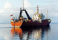
 Farnella |
Scanlon, K.M., 1986, Magnetic and bathymetric data from R/V Farnella Cruise FRNL 85-4 in the Puerto Rico and U.S. Virgin Islands exclusive economic zone: U.S. Geological Survey Open-File Report 86-399, https://doi.org/10.3133/ofr86399.
Scanlon, K.M., 1989, Seismic-reflection and echo-sounder data from R/V FARNELLA Cruise FRNL85-4 in the Puerto Rico and U.S. Virgin Islands Exclusive Economic Zone: U.S. Geological Survey Open-File Report 90-38, 4 p., URL: https://doi.org/10.3133/ofr9038.
Twichell, D.C., Paskevich, V.F., Delorey, C.M., 1998, GLORIA sidescan-sonar field data and navigation data collected off Puerto Rico in 1985 and the eastern United States in 1987: U.S. Geological Survey Open-File Report 98-619, https://doi.org/10.3133/ofr98619.
| Title | Survey Equipment | Description |
|---|---|---|
| Cruise report | (document not focused on specific equipment) | Chief Scientist's cruise report including personnel, equipment, tabulated information and trackmap. |
| Data inventory | (document not focused on specific equipment) | Cruise Curator's field data inventory. |
| Digital tape record | GLORIA sidescan | Field tape and file description of GLORIA sidescan sonar field data including block descriptions. |
| Geophysics log | (document not focused on specific equipment) | Watchstanders' airgun log including equipment configuration, line start and end times, latitude, longitude, ship movement and speed, general notes about all systems in the water. |
| Contractor's report | (document not focused on specific equipment) | Contract Report (pdf file) Institute of Oceanographic Sciences contract report. Includes personnel, program description, cruise narrative, scientific results and trackmaps. The report specified 4 legs of operation. |
| Survey Equipment | Survey Info | Data Type(s) | Data Collected |
|---|---|---|---|
| GLORIA sidescan | --- | Sidescan | 1985-039-FA-SO-001 (Digital tape(s) of NV-MG-BT, NV-GLORIA PASSES, PROCESSED GLORIA, P.R. COMPOSITE, ) 1985-039-FA-SO-002 (CD ROM disk of GLORIA ATLANTIC GEOTIFF, GLORIA PUERTO RICO GEOTIFF, ) GLORIA sidescan data |
| Air gun | --- | Air Gun / Water Gun | |
| Single channel hydrophone | --- | Air Gun / Water Gun Boomer Bubble Gun Sparker Sub Bottom Profiler | 1985-039-FA-SE-002 (microfilm of ) 1985-039-FA-SE-003 (analog tape of seismic data) 1985-039-FA-SE-001 ( Collection of paper record displays of seismic data( AIR) for lines ) |
| Marine magnetometer | --- | Magnetics | 1985-039-FA-GP-001 (Digital tape(s) of NV-MG-BT, NV-GLORIA PASSES, PROCESSED GLORIA, P.R. COMPOSITE, ) NGDC MGD77 data |
| 3.5 kHz | --- | Sub Bottom Profiler | |
| 10 kHz Bathymetry | --- | Single Beam | 1985-039-FA-BA-001 (Digital tape(s) of NV-MG-BT, NV-GLORIA PASSES, PROCESSED GLORIA, P.R. COMPOSITE, ) NGDC MGD77 data |
| ABC navigation system | --- | Navigation | 1985-039-FA-SE-004 (Digital tape(s) of NV-MG-BT, NV-GLORIA PASSES, PROCESSED GLORIA, P.R. COMPOSITE, ) 1985-039-FA-LN-001 (Digital tape(s) of NV-MG-BT, NV-GLORIA PASSES, PROCESSED GLORIA, P.R. COMPOSITE, ) |
| Transit GPS | --- | Navigation | |
| Dead reckoning | --- | Navigation |