Other ID: LASER 1
Status: Completed
Organization(s): USGS, Woods Hole Coastal and Marine Science Center
Funding Program(s):
Principal Investigator(s): John West
Affiliate Investigator(s): John Suter, Shea Penland - LGS
Information Specialist(s):
Data Type(s): Location-Elevation: Navigation, Seismics: Boomer, Seismics: Sub Bottom Profiler
Scientific Purpose/Goals:
Vehicle(s):
Start Port/Location:
End Port/Location: Cocodrie, LA
Start Date: 1985-06-07
End Date: 1985-06-09
Equipment Used: Datasonics 3.5 kHz profiler, ORE GeoPulse, Northstar 6000 LORAN-C, Single channel hydrophone
Information to be Derived:
Summary of Activity and Data Gathered: Cruise truncated, engines died. DataSonics 3.5: Lines L1-L28; ORE GeoPulse: Lines L1-L28.
Staff: James C. McFarlen, John West
Affiliate Staff:
Notes: No cruise report; information derived from seismic analog tape log.
Location:
Louisiana continental shelf, Louisiana, United States, Gulf of Mexico, North America, North Atlantic;
| Boundaries | |||
|---|---|---|---|
| North: 30.48434 | South: 28.72913 | West: -90.3966 | East: -87.84668 |
Platform(s):
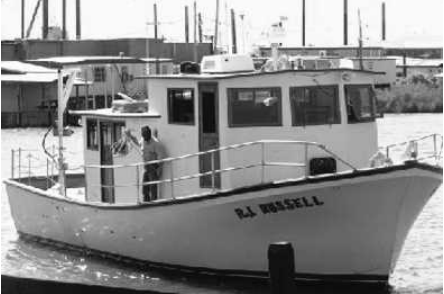 R J Russell |
| Title | Survey Equipment | Description |
|---|---|---|
| Geophysics log | (document not focused on specific equipment) | Watchstander's log describing seismic line and tape start and end times and comments. |
| Survey Equipment | Survey Info | Data Type(s) | Data Collected |
|---|---|---|---|
| Datasonics 3.5 kHz profiler | --- | Sub Bottom Profiler | |
| ORE GeoPulse | --- | Boomer | |
| Northstar 6000 LORAN-C | --- | Navigation | 1985-044-FA-LN-001 (Digital tape(s) of NV, ) |
| Single channel hydrophone | --- | Air Gun / Water Gun Boomer Bubble Gun Sparker Sub Bottom Profiler | 1985-044-FA-SE-001 (analog tape of seismic data) |
