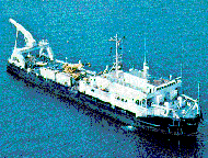
Other ID: AUTEC TEST #003W01
Status: Completed
Organization(s): USGS, Woods Hole Coastal and Marine Science Center
Funding Program(s):
Principal Investigator(s): William Schwab
Affiliate Investigator(s): Kevin O'Toole, PMG
Information Specialist(s):
Data Type(s): Imagery: Photo, Imagery: Video, Sampling: Geology, Sonar: Sidescan
Scientific Purpose/Goals: 1) Collect a data set using the SeaMARC 1B sidescan sonar and ARGO video systems that would allow the construction of a high-resolution geologic map of a segment of sea floor of the Tongue of the Ocean (TOTO), including part of the AUTEC range. 2) Conduct engineering studies of cable and vehicle dynamics for various velocities, configurations, and modes of operation. 3) Test a 100 kHz sidescan sonar system and a Charge Couple Device (CCD) electronic still camera, both mounted on ARGO. 4) Test recently upgraded ALLNAV navigation system.
Vehicle(s):
Start Port/Location: Port Everglades, FL
End Port/Location: Port Everglades, FL
Start Date: 1987-04-17
End Date: 1987-05-01
Equipment Used: ARGO, SeaMARC sidescan sonar system
Information to be Derived: Sea floor map;
Summary of Activity and Data Gathered: Lack of SeaMarc 1B digital data due to computer failure; only analog (paper) data exists. Still camera, video system and sidescan sonar worked well.
Staff: William Schwab
Affiliate Staff:
Kevin O'Toole; Deep Submergence Lab (DSL): Tom Dettweiler
Emile Bergeron
Martin Bowen
Tom Crook
Larry Flick
Andy Bowen
Mark Grosenbaugh
Jim Newman
Bill Lange; U.S. Navy: Mike Serafine. NOTE: The following names are not included on the pre-cruise report
but are listed with others on the pre-cruise crew list as authors for final post-cruise paper: Robert Ballard - WHOI
S.R. Gegg - WHOI
Elazar Uchupi - WHOI.
Notes: Original Center People field contained: William Schwab, Kevin O'Toole.
Location:
Tongue of the Ocean, Andros Island, AUTEC Weapons Range, Bahamas, North America, North Atlantic;
| Boundaries | |||
|---|---|---|---|
| North: 24.48333 | South: 24.31667 | West: -77.6333 | East: -77.43333 |
Platform(s):
 Seacon |
| Survey Equipment | Survey Info | Data Type(s) | Data Collected |
|---|---|---|---|
| ARGO | --- | Photo Video Geology | |
| SeaMARC sidescan sonar system | --- | Sidescan | 1987-014-FA-SO-001 (microfilm of ) |