Other ID: BRKN88-1
Status: Completed
Organization(s): USGS, Woods Hole Coastal and Marine Science Center
Funding Program(s):
Principal Investigator(s): Juan Luis Trias
Affiliate Investigator(s):
Information Specialist(s):
Data Type(s): Location-Elevation: Navigation, Sampling: Biology, Sampling: Geology, Seismics: Boomer
Scientific Purpose/Goals: Locate offshore sand supply that might possibly be suitable for nourishing the eroding beach along Villa Esperanza shoreline. This study is part of the coastal erosion study of Puerto Rico presently in its beginning stages.
Vehicle(s):
Start Port/Location: Esperenza, Vieques, Puerto Rico
End Port/Location: Esperenza, Vieques, Puerto Rico
Start Date: 1988-05-21
End Date: 1988-05-25
Equipment Used: Boomer, Grab sampler, Shipek grab, Motorola Mini-Ranger III, Single channel hydrophone
Information to be Derived: Grain size analysis; Sea floor map; Morphology;
Summary of Activity and Data Gathered: The hard-earned seismic coverage was of sufficient quality and quantity to identify sand deposits and to infer their composition. Just outside (to the south) of Puerto Real, about even with the two small islands, Cayo de tierra and Cayo Afuera, there is a shore-parallel feature whose seismic signature suggests rock. This is most likely a reef, probably a flourishing reef. The feature is at about 10 meters water depth. Seaward of that feature is a wedge of sand, lapping landward onto the previously inferred reef. The sand wedge extends seaward about 200 or so meters and terminates behind another shore-parallel feature at about 20 meters water depth. This feature is also inferred to be a reef. Diver observations were not made because of weather conditions. Seaward of this second feature is another wedge of sand that extends for a few hundred meters until it terminates just landward of what is inferred to be a drowned Pleistocene (?) reef at the present shelf edge. In addition to these sand deposits, there are numerous Pleistocene (?) channels on the shelf, inside the islands, that are filled with sediment. These are also potential sources of sand for beach replenishment. Unfortunately, the weather was at all times too rough for vibracoring. Even a larger vessel, such as the DNR's JEAN A, would not have helped in this regard. Thus, it will be necessary to return to Vieques to obtain a few vibracores and a handful of grab samples outside of the bay. With good weather, all the samples could be obtained in just two days of field work. It is critical for beach replenishment that the mud content of the snad not exceed a value of more or less 2%, thus the composition and texture of the sediment need to be known in some detail. A larger vessel would have allowed us to obtain more seismic and more grab samples. More seismic is not really necessary, but more grab samples could, perhaps, take the place of vibracores. More serious than sampling limitations of the small vessel were the logistical problems caused by not enough equipment storage space and crew housing/feeding facilities. Uniboom lines: 27; Beach samples: 5; Shipek samples: 12; Vibracore: 0; several beach profiles and observations.
Staff: David Nichols
Affiliate Staff:
Thorton Tyson - ET Assistant
USGS-Woods Hole; David Bush - Ch. Sci.
USGS-San Juan; Juan Trias - Geologist/sedimentology
USGS-San Juan; Rodney Priddy - student
Duke; Rob Thieler - student
Duke; Maritza Barreto - student
UPR; Nalini Torres - student
UPR; Eladio Rodriguez - ship pilot/diver
consultant; Wally Matos - ship crew/diver
consultant; Gerardo Cabrera - ship crew/diver
consultant
Notes: We went to Vieques to search the near offshore area for a suitable sand supply to be used to replenish the eroding beach of Villa Esperanza. Some of this data will be used for Maritza Barreto's master's thesis. Original Center People field contained: Dave Nichols - Electronic Technician, Thorton Tyson - ET Assistant.
Location:
Puerto Real, off Villa Esperanza, south coast of Vieques, Puerto Rico, Caribbean Sea, United States, North America, North Atlantic;
| Boundaries | |||
|---|---|---|---|
| North: 18.3 | South: 18.2 | West: -65.75 | East: -65.25 |
Platform(s):
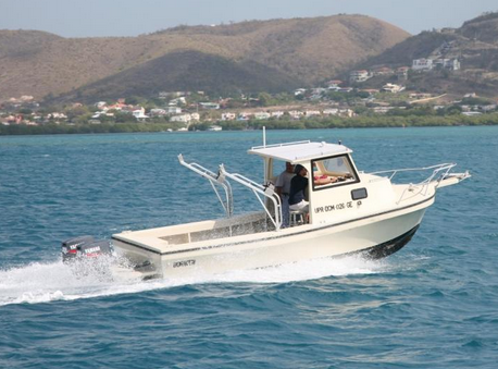
 Boriken |
| Title | Survey Equipment | Description |
|---|---|---|
| Cruise report | (document not focused on specific equipment) | Chief Scientist's report including objective, equipment, personnel, daily work, tabulated information, and cruise summary and findings. |
| Survey Equipment | Survey Info | Data Type(s) | Data Collected |
|---|---|---|---|
| Boomer | --- | Boomer | |
| Grab sampler | --- | Biology Geology | |
| Shipek grab | --- | Geology | |
| Motorola Mini-Ranger III | --- | Navigation | |
| Single channel hydrophone | --- | Air Gun / Water Gun Boomer Bubble Gun Sparker Sub Bottom Profiler | 1988-005-FA-SE-001 ( Collection of paper record displays of seismic data( UNI) for lines ) 1988-005-FA-SE-002 (analog tape of seismic data) |