Other ID: NEECHO 88-2-LM; N-2-88-LM
Status: Completed
Organization(s): USGS, Woods Hole Coastal and Marine Science Center
Funding Program(s):
Principal Investigator(s): John S. Schlee
Affiliate Investigator(s):
Information Specialist(s):
Data Type(s): Seismics: Boomer, Other: Unknown, Sonar: Single Beam, Sampling: Biology, Sampling: Geology, Location-Elevation: Navigation, Sonar: Sidescan, Seismics: Sub Bottom Profiler
Scientific Purpose/Goals: Geophysical survey (sidescan sonar) and sampling.
Vehicle(s):
Start Port/Location: Calumet Coast Guard Station, Portage, IN
End Port/Location: Pastrick Marina, E. Chicago, IN
Start Date: 1988-08-15
End Date: 1988-08-20
Equipment Used: Single channel hydrophone, Huntec profiling system (500-2500 Hz), Echosounder, Grab sampler, Loran-C, Sidescan sonar
Information to be Derived:
Summary of Activity and Data Gathered: Sediment samples: 60; Sidescan sonar: 26 lines (106.2 km).
Staff: John S. Schlee
Affiliate Staff:
Notes:
Location:
Indiana Shoals, Indiana, Southern Lake Michigan, Great Lakes, United States, North America;
| Boundaries | |||
|---|---|---|---|
| North: 41.75 | South: 41.65 | West: -87.5 | East: -87.33 |
Platform(s):
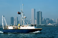
 Neecho |
Foster, D.S., and Colman, S.M., 1991, Preliminary interpretation of the high-resolution seismic stratigraphy beneath Lake Michigan: U.S. Geological Survey Open-File Report 91-021, https://doi.org/10.3133/ofr9121.
| Title | Survey Equipment | Description |
|---|---|---|
| Cruise report | (document not focused on specific equipment) | Chief Scientist's cruise report including a daily narrative, trackmap, and tabulated information. |
| Sidescan log | Sidescan sonar | Log of sidescan sonar lines - start and end of line and tape. Also includes comments about the Huntec system. Log book covers 2 cruises (1988-009-FA and 1988-012-FA). |
| Survey Equipment | Survey Info | Data Type(s) | Data Collected |
|---|---|---|---|
| Single channel hydrophone | --- | Air Gun / Water Gun Boomer Bubble Gun Sparker Sub Bottom Profiler | 1988-012-FA-SE-001 (Collection of paper record displays of seismic data (SBP) for lines 1 thru 26) |
| Huntec profiling system (500-2500 Hz) | Paper records indicate "Huntec". | Boomer | |
| Echosounder | --- | Single Beam | 1988-012-FA-BA-001 (Digital tape(s) of NV/BT-MINIRANGER, ) |
| Grab sampler | --- | Biology Geology | |
| Loran-C | --- | Navigation | 1988-012-FA-LN-001 (Digital tape(s) of NV/BT-MINIRANGER, ) |
| Sidescan sonar | --- | Sidescan | 1988-012-FA-SO-001 (Collection of paper record displays of sidescan sonar data (SSS) for lines 1 thru 26) |