Other ID: SIMS88-1
Status: Completed
Organization(s): USGS, Woods Hole Coastal and Marine Science Center
Funding Program(s):
Principal Investigator(s): Stephen Colman
Affiliate Investigator(s):
Information Specialist(s):
Data Type(s): Seismics: Sub Bottom Profiler, Seismics: Boomer, Seismics: Air Gun / Water Gun, Seismics: Sparker, Location-Elevation: Navigation
Scientific Purpose/Goals: Collection of seismic reflection data in Lake Michigan to define the stratigraphy and sediment character of the deposits below the lake floor. The seismic reflection data was used to choose final core locations for the second leg of the cruise. These cores will be used to develop a closely dated record of sedimentation and paleoenviromental conditions in the lake. The cores and the seismic reflection data together will be used to determine the history of lake-level fluctuations over the last several thousand years.
Vehicle(s):
Start Port/Location:
End Port/Location:
Start Date: 1988-09-06
End Date: 1988-09-13
Equipment Used: ORE 140 transceiver/1036 transducer sub-bottom profiler, Boomer, Benthos AQ-4 10-element hydrophone streamer, Megapulse Accufix 500 LORAN-C
Information to be Derived:
Summary of Activity and Data Gathered: The cruise was generally successful although plagued with mobilization problems and some weather difficulties. Two storms, one of which was the remains of Hurricane Gilbert, forced our return to port. Mobilization for the seismic leg (Leg 1) took 3 days instead of the allotted 2, and the coring mobilization (Leg 2) took 6 days instead of the allotted 2. Nevertheless, a total of 950 km of seismic reflection profiles were collected and 13 cores (6 piston and 7 vibracores) were obtained. Analysis of the seismic reflection profiles and cores should provide sufficient data to begin to decipher the history of changes in lake level in Lake Michigan over the last several thousand years and the lake's response to those changes.
Staff: David Foster, Barry Irwin, Robert N. Oldale, Kenneth F. Parolski
Affiliate Staff:
Jim Clark (Calvin College)
Jim Meer (U. Wisconsin
Milwaukee); Jim Katsolis - coring contractor party chief (Alpine Ocean Seismic Surveys)
Notes: This cruise was Leg 1 of two legs: 88014 (Leg 1, Seismics) and 88015 (Leg 2, Seismics and Coring). Original Center People field contained: Dave Foster, Bob Oldale, Ken Parolski (Technician), Barry Irwin (Navigation specialist).
Project = Lake Level and Sed. History (LLASH), Lake Level and Sed. History (LLASH)
Location:
Lake Michigan, Great Lakes, United States, North America;
| Boundaries | |||
|---|---|---|---|
| North: 44.5 | South: 41.5 | West: -88 | East: -86 |
Platform(s):
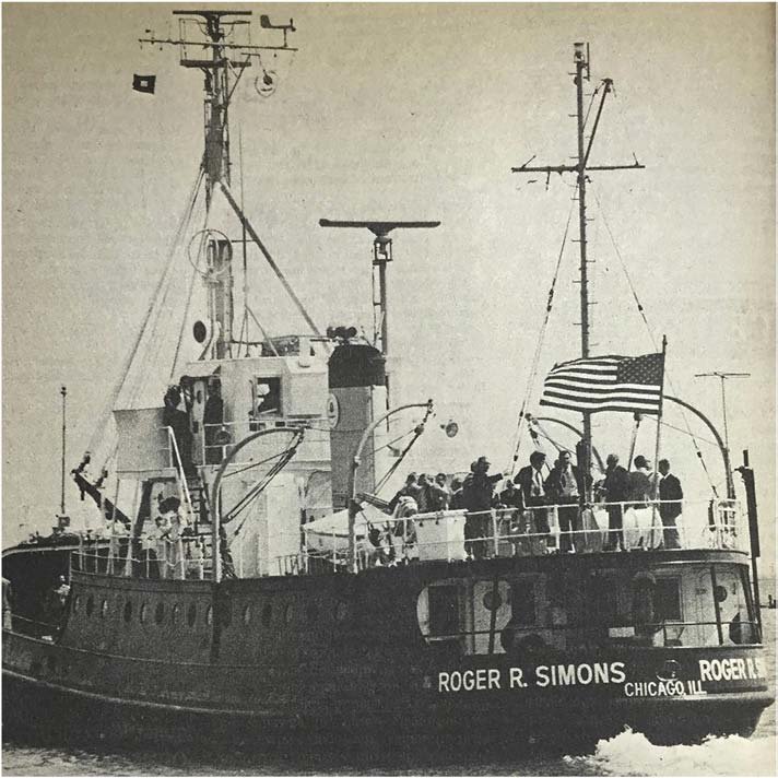 Roger R. Simons |
Foster, D.S., and Colman, S.M., 1991, Preliminary interpretation of the high-resolution seismic stratigraphy beneath Lake Michigan: U.S. Geological Survey Open-File Report 91-021, https://doi.org/10.3133/ofr9121.
| Title | Survey Equipment | Description |
|---|---|---|
| Cruise report | (document not focused on specific equipment) | Chief Scientist's cruise report including personnel, purpose, equipment and equipment performance, brief cruise summary, and table of start and end of lines. This information covers 2 field activities (1988-014-FA and 1088-015-FA) |
| Data inventory | (document not focused on specific equipment) | Cruise Curator's inventory of data collected aboard ship. |
| Survey Equipment | Survey Info | Data Type(s) | Data Collected |
|---|---|---|---|
| ORE 140 transceiver/1036 transducer sub-bottom profiler | --- | Sub Bottom Profiler | 1988-014-FA-SE-003 (analog tape of seismic data) |
| Boomer | --- | Boomer | |
| Benthos AQ-4 10-element hydrophone streamer | --- | Air Gun / Water Gun Boomer Sparker | 1988-014-FA-SE-002 (microfilm of ) 1988-014-FA-SE-001 ( Collection of paper record displays of seismic data( SBP) for lines ) |
| Megapulse Accufix 500 LORAN-C | --- | Navigation | 1988-014-FA-LN-002 (Digital tape of NV-FINAL data: inv. # 3915.) 1988-014-FA-LN-001-02 (Piston and vibracore location map.) 1988-014-FA-LN-001-01 (Huntec Sea Otter boomer and 3.5 kHz track line map.) |
