Other ID: AT1-88-BH
Status: Completed
Organization(s): USGS, Woods Hole Coastal and Marine Science Center
Funding Program(s):
Principal Investigator(s): Richard Rendigs
Affiliate Investigator(s):
Information Specialist(s): Richard Rendigs
Data Type(s): Sampling: Geology, Seismics: Sub Bottom Profiler, Location-Elevation: Navigation
Scientific Purpose/Goals: The objective of the cruise was to collect twelve vibracores from specified sites within Boston Harbor. The location of these sites was determined from selected high-resolution seismic survey lines conducted during the summer of 1987 by the U.S. Geological Survey. The cores will be x-rayed, split, described, photographed and subsampled for geochemical, geotechnical and sedimentologic analyses. Correlation of lithologic results will be utilized to further define the Holocene and Pleistocene stratigraphic history of Boston Harbor.
Vehicle(s):
Start Port/Location: Pier 4, Charlestown, Boston, MA
End Port/Location: Pier 4, Charlestown, Boston, MA
Start Date: 1988-09-26
End Date: 1988-09-28
Equipment Used: ORE 140 transceiver/1036 transducer sub-bottom profiler, Alpine Vibracorer, Megapulse Accufix 500 LORAN-C, Northstar 6000 LORAN-C
Information to be Derived:
Summary of Activity and Data Gathered: A 10- to 15-minute high-resolution seismic survey was conducted at each site prior to coring operations. A buoy was then deployed along the seismic line as a marker for each coring site. The ship would then anchor alongside the buoy and commence coring operations. Survey stations: 11; Coring stations: 12; Seismic data: 9.63 km.
Staff: Richard Rendigs, Adam Brown, Carol M. Parmenter, Dave Lubinski
Affiliate Staff:
Ralph Lewis - University of Connecticut
Notes: Project = Boston Harbor, Boston Harbor
From Foghorn: Alpine Geophysical Pneumatic vibracore, GeoPulse seismic system, Megapulse/IBM PC navigation system;
Assumption that it's a 3.5 system and not the GeoPulse boomer system - so using the ORE
Location:
Boston Harbor, Massachusetts Bay, Massachusetts, United States, North America, North Atlantic;
| Boundaries | |||
|---|---|---|---|
| North: 42.41 | South: 42.23 | West: -71.7 | East: -70.6 |
Platform(s):
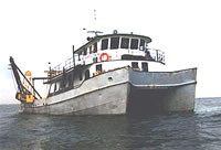 Atlantic Twin |
Rendigs, R.R., and Oldale, R.N., 1990, Map showing the results of a subbottom acoustic survey of Boston Harbor, Massachusetts: U.S. Geological Survey Miscellaneous Field Studies Map MF-2124, URL: https://doi.org/10.3133/mf2124.
| Survey Equipment | Survey Info | Data Type(s) | Data Collected |
|---|---|---|---|
| ORE 140 transceiver/1036 transducer sub-bottom profiler | --- | Sub Bottom Profiler | |
| Alpine Vibracorer | --- | Geology | 1988-017-FA-SC-001-02 (12 Visual Core Descriptions (1, 3-6, 11-13, 15-18)) 1988-017-FA-SC-001-01 (12 Polaroid photos of split cores 1, 3-6, 11-13, 15-18) |
| Megapulse Accufix 500 LORAN-C | --- | Navigation | 1988-017-FA-LN-001 (Floppy disk(s) containing NV-MEGAPULSE, ) 1988-017-FA-NL-001 (Logs for PEN LOG, WATCHSTANDER, CRSC, ) |
| Northstar 6000 LORAN-C | --- | Navigation |
