Other ID: none
Status: Completed
Organization(s): USGS, Woods Hole Coastal and Marine Science Center
Funding Program(s):
Principal Investigator(s): Kenneth F. Parolski
Affiliate Investigator(s): Earl Young - WHOI
Information Specialist(s):
Data Type(s): Sonar: Sidescan, Seismics: Boomer, Seismics: Sub Bottom Profiler
Scientific Purpose/Goals: Comparison tests of various sub-bottom profiling equipment. Test and evaluation of Klein analog and digital sidescan systems.
Vehicle(s):
Start Port/Location: Woods Hole, MA
End Port/Location: Woods Hole, MA
Start Date: 1989-12-06
End Date: 1989-12-06
Equipment Used: Single channel hydrophone, Klein 531 sidescan, Huntec profiling system (500-2500 Hz), GeoPulse uniboom
Information to be Derived:
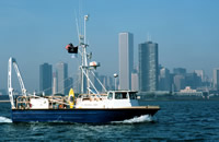
Summary of Activity and Data Gathered: NEECHO was originally mobilized to support a joint USGS/WHOI OBS program which was postponed after the boat was in the water. This delay afforded a good opportunity for MSO to test and evaluate seismic instrumentation. A test line was selected based on some lines run off the Elizabeth Islands during August 1979. GeoPulse, UNIBOOM and HUNTEC sound sources were run at various power settings during the cruise. The signal was routed through four different signal processors and displayed on EPC recorders. Different amplifier and filter settings were used. The Klein digital sonar was tested and six analog sidescan lines off Lackey's Bay were run for WHOI. A shallow water profiling sled built by MSO was also field tested during the cruise.
Staff: Barry Irwin, David Mason, David Nichols, Nancy K. Soderberg, Kenneth F. Parolski
Affiliate Staff:
Earl Young - WHOI
Notes: Original Center People field contained: Ken Parolski, Dave Nichols, Dave Mason, Nancy Soderberg, Barry Irwin (navigator).
Location:
Vineyard Sound, Massachusetts, United States, North America, North Atlantic;
| Boundaries | |||
|---|---|---|---|
| North: 41.47669 | South: 41.35826 | West: -70.8453 | East: -70.72311 |
Platform(s):
 Neecho |
| Survey Equipment | Survey Info | Data Type(s) | Data Collected |
|---|---|---|---|
| Single channel hydrophone | --- | Air Gun / Water Gun Boomer Bubble Gun Sparker Sub Bottom Profiler | |
| Klein 531 sidescan | --- | Sidescan | |
| Huntec profiling system (500-2500 Hz) | --- | Boomer | |
| GeoPulse uniboom | --- | Boomer |