Other ID: Leg 2, F-90-4, F490GM
Status: Completed
Organization(s): USGS, Woods Hole Coastal and Marine Science Center
Funding Program(s):
Principal Investigator(s): William Schwab, David Twichell
Affiliate Investigator(s):
Information Specialist(s): Matthew Arsenault
Data Type(s): Biological Field Study: Experiments (biological), Location-Elevation: Navigation, Seismics: Sub Bottom Profiler, Sampling: Geology
Scientific Purpose/Goals: To study recent sedimentary processes on the Mississippi Fan and along the base of the Florida Escarpment.
Vehicle(s):
Start Port/Location: Tampa, FL
End Port/Location: Tampa, FL
Start Date: 1990-04-12
End Date: 1990-04-26
Equipment Used: 3.5 kHz, Loran-C, Piston corer, GPS (wh), Other
Information to be Derived: see summary
Summary of Activity and Data Gathered: 3.5 kHz (from Leg 1 and Leg 2) - 2280 km. Piston cores - 55; gravity cores - 12.
Staff: William Danforth, Barry Irwin, Thomas O'Brien, William Schwab, David Twichell, Dave Lubinski, Richard Rendigs, William Winters
Affiliate Staff:
L. Bader - USGS PMG
J. Barber - USGS PMG
H. Lee - USGS PMG
H. Nelson - USGS PMG
J. Vaughan - USGS PMG
N. Kenyon - IOS
T. Crook - WHOI
C. Paull - UNC
W. Ussler - UNC
Notes: Physical data holdings at PCMSC;
Farnella was used.
Project = MS Fan Ground Truth Program, MS Fan Ground Truth Program
Information from Foghorn: Piston corer, 3.5 kHz surface towed sub-bottom profiler, LORAN-C and GPS navigation system, Velocimeter;
Location:
Mississippi Fan, Florida Escarpment, eastern Gulf of Mexico, United States, North America, North Atlantic;
| Boundaries | |||
|---|---|---|---|
| North: 27 | South: 25 | West: -87 | East: -84.5 |
Platform(s):
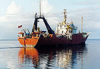
 Farnella |
Paskevich, V.F., Twichell, D.C., and Schwab, W.C., 2001, SeaMARC 1A sidescan sonar mosaic, cores and depositional interpretation of the Mississippi Fan—ArcView GIS data release: U.S. Geological Survey Open-File Report 2000-352, https://doi.org/10.3133/ofr00352.
Twichell, D.C. Cross, V.A., Paskevich, V.F., Hutchinson, D.R., Winters, W.J., and Hart, P.E., 2006, GIS of selected geophysical and core data in the northern Gulf of Mexico continental slope collected by the U.S. Geological Survey: U.S. Geological Survey Open-File Report 2005-1071, DVD-ROM, also available from https://doi.org/10.3133/ofr20051071.
| Title | Survey Equipment | Description |
|---|---|---|
| Cruise report | (document not focused on specific equipment) | Chief Scientists' cruise report including personnel, equipment, objective, cruise narrative, tabulated information, transponder net locations, area maps, sidescan sonar trackmap for first leg F-90-3 (FA 90001) and core locations from second leg F-90-4 (FA 90003). |
| Core log | Piston corer | Piston core and section log containing identifier, location, water depth, head weight, penetration, length, subsection. |
| Station log | (document not focused on specific equipment) | Station and core information, length of time to bottom, coordinates, pull out strength. |
| Document 751 | (document not focused on specific equipment) | Visual description of cores. |
| Survey Equipment | Survey Info | Data Type(s) | Data Collected |
|---|---|---|---|
| 3.5 kHz | --- | Sub Bottom Profiler | 1990-003-FA-SE-001 ( Collection of paper record displays of seismic data( 3.5K) for lines ) 1990-003-FA-SE-002 (microfilm of ) |
| Loran-C | --- | Navigation | 1990-003-FA-LN-001 (Floppy disk(s) containing NAV, NAV, NAV, ) |
| Piston corer | --- | Geology | 1990-003-FA-NL-001-02 (Piston core and section log containing identifier, location, water depth, head weight, penetration, length, subsection, etc.
) 1990-003-FA-NL-001-04 (Visual description of piston, gravity and trigger cores. ) 1990-003-FA-SC-001 (CORE samples) 1990-003-FA-PH-001 (Photo prints of complete split cores: B/W; 1 photo for each of cores 21-67, plus negatives.) |
| GPS (wh) | --- | Navigation | |
| Other | --- | --- | --- |