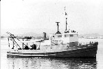
Other ID: JENA90-1
Status: Completed
Organization(s): USGS, Woods Hole Coastal and Marine Science Center
Funding Program(s):
Principal Investigator(s): Catherine Delorey, Lawrence Poppe
Affiliate Investigator(s):
Information Specialist(s):
Data Type(s): Seismics: Boomer, Sonar: Single Beam, Sampling: Geology, Location-Elevation: Navigation
Scientific Purpose/Goals: To conduct a high-resolution seismic survey and obtain surface and subsurface sediment samples in an effort to quantitatively determine the effects of Hurricane Hugo on a large sand and gravel deposit located off Vieques Island.
Vehicle(s):
Start Port/Location: Mosquito Pier, Vieques Island, Puerto Rico
End Port/Location: Mosquito Pier, Vieques Island, Puerto Rico
Start Date: 1990-11-02
End Date: 1990-11-07
Equipment Used: Single channel hydrophone, Huntec profiling system (500-2500 Hz), ODOM 200 kHz depth recorder, Van Veen grab sampler, Shipek grab, Alpine Vibracorer, Slide hammer corer, Motorola Falcon IV Microwave relay Mini-Ranger
Information to be Derived:
Summary of Activity and Data Gathered:
Staff: Dann Blackwood, Barry Irwin, Lawrence Poppe, Kenneth F. Parolski, Catherine Delorey
Affiliate Staff:
USGS-Reston: Ronald Circe; USGS-San Juan: Rafael Rodrigues
Juan Trias
Milton Carlo
Notes:
Project = Hurricane Hugo Response, Hurricane Hugo Response
Location:
Escollo de Arena, Isla de Vieques, Puerto Rico, United States, Caribbean Sea, North America, North Atlantic;
| Boundaries | |||
|---|---|---|---|
| North: 18.17397936 | South: 18.12544178 | West: -65.62485 | East: -65.49745626 |
Platform(s):
 Jean A |
| Title | Survey Equipment | Description |
|---|---|---|
| Cruise report | (document not focused on specific equipment) | Chief scientist's cruise report including personnel, purpose, equipment, tabulated information, locations of diver-assisted vibracores, hammer cores and Shipek grab samples, and seismic survey trackmap. |
| Navigation log | (document not focused on specific equipment) | Navigation notes regarding satellite fixes, Miniranger stations, and data acquisition for Leg 1 (FA 90043) and Leg 2 (FA 90046). |
| Core log | (document not focused on specific equipment) | Log describing acquisition by vibracore or diver-assisted hammer, with time, water depth, barrel length, recovered length, geological description, position. |
| Grab sampler log | Shipek grab | Grab log describing time, position, water depth, station identifier. |
| Geophysics log | Huntec profiling system (500-2500 Hz) | Geopulse log describing equipment configuration, performance, line start and end, Miniranger coordinates, |
| Survey Equipment | Survey Info | Data Type(s) | Data Collected |
|---|---|---|---|
| Single channel hydrophone | --- | Air Gun / Water Gun Boomer Bubble Gun Sparker Sub Bottom Profiler | 1990-043-FA-SE-003 (analog tape of seismic data) 1990-043-FA-SE-001 (Collection of paper record displays of seismic data( E/S) for lines) 1990-043-FA-SE-002 (microfilm of) |
| Huntec profiling system (500-2500 Hz) | --- | Boomer | |
| ODOM 200 kHz depth recorder | --- | Single Beam | |
| Van Veen grab sampler | --- | Geology | |
| Shipek grab | --- | Geology | |
| Alpine Vibracorer | --- | Geology | |
| Slide hammer corer | --- | Geology | |
| Motorola Falcon IV Microwave relay Mini-Ranger | --- | Navigation | 1990-043-FA-LN-001-01 (Miniranger Data (txt file) Raw miniranger data.) |