Other ID: JA-90-3
Status: Completed
Organization(s): USGS, Woods Hole Coastal and Marine Science Center
Funding Program(s):
Principal Investigator(s): William Schwab
Affiliate Investigator(s): Richard Webb - USGS-WRD
Information Specialist(s):
Data Type(s): Seismics: Boomer, Location-Elevation: Navigation, Sampling: Geology, Seismics: Sub Bottom Profiler, Sonar: Sidescan
Scientific Purpose/Goals: High-resolution mapping of coral reef complex and surrounding area to develop basemap for future environmental studies anticipated by possible discharge from regional water treatment plant and heavy sediment discharge from Anasco River.
Vehicle(s):
Start Port/Location: Mayaguez, Puerto Rico
End Port/Location: Mayaguez, Puerto Rico
Start Date: 1990-12-07
End Date: 1990-12-15
Equipment Used: GeoPulse uniboom, Single channel hydrophone, Klein 531 sidescan, 3.5 kHz, Motorola Mini-Ranger III
Information to be Derived:
Summary of Activity and Data Gathered: Sidescan sonar; mosaic 3.5 kHz: 89 km; Uniboom: 89 km; Shipek samples: 33.
Staff: William Danforth, Barry Irwin, Thomas O'Brien, Rafael W. Rodriguez, William Schwab
Affiliate Staff:
Richard Webb - co-Ch. Sci.
USGS-WRD-San Juan
Notes: Project = Anasco River, Anasco River
Location:
Rio Grande de Anasco, Manchas Interiores, Manchas Exteriores, Mayaguez Bay, Puerto Rico, Caribbean Sea, United States, North America, North Atlantic;
| Boundaries | |||
|---|---|---|---|
| North: 18.38368723 | South: 18.02383146 | West: -65.8191 | East: -65.42492676 |
Platform(s):
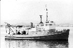
 Jean A |
Cross, V.A., Schwab, W.C., 1999, Digital sidescan-sonar imagery of the Manchas Interiores-Manchas Exteriores coral reef complex, Mayguez, Puerto Rico: .S. Geological Survey Open-File Report 98-427, CD-ROM, https://doi.org/10.3133/ofr98427.
Schwab, W.C., Webb, R.M.T., Danforth, W.W., O'Brien, T.F., and Irwin, B.J., 1991, High-resolution sidescan-sonar imagery of the Manchas Interiores-Manchas Exteriores coral reef complex, Mayaguez, Puerto Rico: U.S. Geological Survey Open-File Report 91-436, 15 p., URL: https://doi.org/10.3133/ofr91436.
| Title | Survey Equipment | Description |
|---|---|---|
| Navigation log | (document not focused on specific equipment) | Navigation log indicating start and end of lines, with some information about satellite fixes, GPS and miniranger stations. |
| Q-Mips log | Klein 531 sidescan | Q-Mips log describing start and end of lines, files, tapes, equipment configuration, data acquisition notes. |
| Survey Equipment | Survey Info | Data Type(s) | Data Collected |
|---|---|---|---|
| GeoPulse uniboom | --- | Boomer | |
| Single channel hydrophone | --- | Air Gun / Water Gun Boomer Bubble Gun Sparker Sub Bottom Profiler | 1990-049-FA-SE-002 (microfilm of) |
| Klein 531 sidescan | --- | Sidescan | 1990-049-FA-SO-001 (Digital tape(s) of SSS L3-4, SSS L5-6, ) |
| 3.5 kHz | --- | Sub Bottom Profiler | 1990-049-FA-SE-001 ( Collection of paper record displays of seismic data( 3.5K) for lines ) |
| Motorola Mini-Ranger III | --- | Navigation | 1990-049-FA-LN-001 (Navigation trackline plot for field activity 90049) 1990-049-FA-LN-002 (Floppy disk(s) containing NAVGPS+MINIRANGER, NAVGPS+MINIRANGER, NAVGPS+MINIRANGER, NAVGPS+MINIRANGER, NAV-GPS+MINIRANGER, NAV-GPS+MINIR, NAV-GPS+MINIR, NAV-GPS+MINIR, NAV-GPS+MINIR, NAV-GPS+MINIR, NAV-GPS+MINIR, NAV-GPS+MINIR, ) |