Other ID: none
Status: Completed
Organization(s): USGS, Woods Hole Coastal and Marine Science Center
Funding Program(s):
Principal Investigator(s): Juan Luis Trias
Affiliate Investigator(s): Elazar Uchupi - WHOI
Information Specialist(s):
Data Type(s): Location-Elevation: Navigation, Sampling: Geology, Seismics: Boomer, Seismics: Sub Bottom Profiler
Scientific Purpose/Goals: Marine geologic maps of Puerto Rico Insular Shelf, Salinas to Jobos area and Caja de Muertos area by Trias and Uchupi, scale 1:40,000.
Vehicle(s):
Start Port/Location: Ponce Harbor, Puerto Rico
End Port/Location: Aquirre Harbor, Puerto Rico
Start Date: 1991-11-06
End Date: 1991-11-21
Equipment Used: Shipek grab, Boomer, Motorola Mini-Ranger III, 3.5 kHz, Single channel hydrophone
Information to be Derived:
Summary of Activity and Data Gathered: Approximately 200 nautical miles of shallow seismic reflection data were collected in the nearshore waters of Caja de Muertos and Salinas-Jobos to study sub-bottom profiles. More than 200 surface samples have been analyzed for textural and chemical qualities and to delineate the boundaries of the sediment facies. The results of this investigation will be published in the Marine Geologic Map of Caja de Muertos and the Marine Geologic Map of Salinas to Jobos area. The marine geologic maps will provide reconnaissance level information on bathymetry, geologic structure, surficial sediment characteristics and coastal processes. These maps will be part of a geologic mapping program covering the Puerto Rico insular shelf that is being carried out by the U.S. Geological Survey in cooperation with the Puerto Rico Department of Natural Resources.
Staff: Kenneth F. Parolski
Affiliate Staff:
Juan Luis Trias - SJFC
Milton Carlo - SJFC; Elazar Uchupi - WHOI
Notes:
Location:
south coast of Puerto Rico, Caja de Muertos, Salinas, Jobos, Puerto Rico, United States, Caribbean Sea, North America, North Atlantic;
| Boundaries | |||
|---|---|---|---|
| North: 18 | South: 17.8 | West: -66.7 | East: -66.1 |
Platform(s):
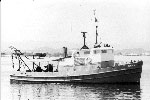
 Jean A |
Trias, J.L., and Scanlon, K.M., 1992, High-resolution seismic-reflection and echo-sounder data from cruise JENA 91-11 on the south shelf of Puerto Rico-Isla Caja de Muertos and Salinas to Jobos areas: U.S. Geological Survey Open-File Report 92-513, 3 p., URL: https://doi.org/10.3133/ofr92513.
| Title | Survey Equipment | Description |
|---|---|---|
| Cruise report | (document not focused on specific equipment) | Chief Scientist's cruise report including personnel, objective, equipment, sample location maps, trackmaps. |
| Survey Equipment | Survey Info | Data Type(s) | Data Collected |
|---|---|---|---|
| Shipek grab | --- | Geology | |
| Boomer | --- | Boomer | |
| Motorola Mini-Ranger III | --- | Navigation | 1991-041-FA-LN-001 (Navigation trackline plot for field activity 91041) 1991-041-FA-LN-002-01 (Navigation data recovered from floppy disk) |
| 3.5 kHz | --- | Sub Bottom Profiler | |
| Single channel hydrophone | --- | Air Gun / Water Gun Boomer Bubble Gun Sparker Sub Bottom Profiler | 1991-041-FA-SE-002 (VHS digital tapes for line(s) 1, 2, 3, ) 1991-041-FA-SE-003 (microfilm of ) 1991-041-FA-SE-001 (Collection of paper record displays of seismic data( 3.5K) for lines ) |