Other ID: VERE92-2
Status: Completed
Organization(s): USGS, Woods Hole Coastal and Marine Science Center
Funding Program(s):
Principal Investigator(s): Stephen Colman
Affiliate Investigator(s): E.B. Karabanov, Limnolog. Inst., Irkutsk
Information Specialist(s):
Data Type(s): Biological Field Study: Experiments (biological), Location-Elevation: Navigation, Sampling: Biology, Sampling: Geology, Seismics: Sub Bottom Profiler, Seismics: Air Gun / Water Gun
Scientific Purpose/Goals: To obtain and quantitatively interpret the sedimentary record of changing climate and limnology in Lake Baikal by collecting high-resolution seismic reflection data to delineate the sedimentary environments beneath the lake, defining how these environments have responded to climate change, and locating and correlating the best sites for coring.
Vehicle(s):
Start Port/Location: Listvyanka, Siberia, USSR
End Port/Location: Listvyanka, Siberia, USSR
Start Date: 1992-07-21
End Date: 1992-08-01
Equipment Used: Gravity corer, Piston corer, Box corer, GPS (wh), 3.5 kHz, Single channel hydrophone, Water gun (wh)
Information to be Derived:
Summary of Activity and Data Gathered: See scanned cruise report.
Staff: Susan Carter, Stephen Colman, Kenneth F. Parolski, Richard Rendigs
Affiliate Staff:
P. Hearn
R. Seal
H. Nelson
J. Allen; URI: J. Peck; Limol Inst.: E. Karabanov
A. Bardardinov
L. Granina
V. Kochetkov
O. Levina
O. Khlistov
S. Bazileva
E. Stolbova
E. Kapnakova; Irkutsk Poly.: P. Mekhonoshin; Inst. Geog. - Cart.: P. Yermikova
Notes: Original Center People field contained: S. Colman, P. Hearn, R. Seal, H. Nelson, S. Carter, K. Parolski, R. Rendigs, J. Allen.
Project = Global Change Stratigraphy, Global Change Stratigraphy
Information from Foghorn: Russian: Gravity corer, box corer; WHOI: 8-cm piston corer; Seismic reflection: 3.5 kHz, water gun;HP 8-track analogue recorder;
Location:
Selenga Delta, Buguldeika, Academician Ridge, Maloye Marye, Lake Baikal, Siberia, Russia, USSR, Asia;
| Boundaries | |||
|---|---|---|---|
| North: 53.96613805 | South: 51.69979985 | West: 104.31145263 | East: 108.63124642 |
Platform(s):
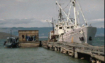
 Vereshchagin |
FAN 1992-015-FA has data viewable in the GeoMappApp/Virtual Ocean applications. To view this data in these applications go to http://www.geomapapp.org/ and http://www.virtualocean.org/. See the instructions for locating USGS data in these applications. You can also view the imagery created from the SEGY data at https://cmgds.marine.usgs.gov/images.php?cruise=1992-015-FA.
| Title | Survey Equipment | Description |
|---|---|---|
| Cruise report | (document not focused on specific equipment) | Chief Scientist's cruise report including personnel, purpose, equipment and equipment performance, narrative of cruise operations, problems encountered, and summary. Also has table of core locations and trackmaps. |
| Survey Equipment | Survey Info | Data Type(s) | Data Collected |
|---|---|---|---|
| Gravity corer | --- | Geology | |
| Piston corer | --- | Geology | |
| Box corer | --- | Biology Geology | 1992-015-FA-SC-001 (CORE samples) |
| GPS (wh) | --- | Navigation | 1992-015-FA-LN-001 (Navigation trackline plot for field activity 92015) 1992-015-FA-LN-002-01 (Raw navigation data files.) |
| 3.5 kHz | --- | Sub Bottom Profiler | |
| Single channel hydrophone | --- | Air Gun / Water Gun Boomer Bubble Gun Sparker Sub Bottom Profiler | 1992-015-FA-SE-001 (Collection of paper record displays of seismic data( 3.5K) for lines ) 1992-015-FA-SE-003 (analog tape of seismic data) 1992-015-FA-SE-002 (microfilm of ) Water gun data |
| Water gun (wh) | --- | Air Gun / Water Gun |