Other ID: ATL 9401
Status: Completed
Organization(s): USGS, Woods Hole Coastal and Marine Science Center
Funding Program(s):
Principal Investigator(s): Marilyn ten Brink
Affiliate Investigator(s): Mead Allison - WHOI/USGS
Information Specialist(s):
Data Type(s): Sampling: Geology, Seismics: Sub Bottom Profiler
Scientific Purpose/Goals: Collect high-resolution CHIRP sub-bottom data and 2-3 m long gravity cores to determine post-glacial history of formation of the modern anthropogenic impact of shelf dumping on the area.
Vehicle(s):
Start Port/Location: Pt. Pleasant Beach, NJ
End Port/Location: Pt. Pleasant Beach, NJ
Start Date: 1994-09-20
End Date: 1994-09-23
Equipment Used: Subbottom profiler, Gravity corer
Information to be Derived:
Summary of Activity and Data Gathered:
Staff: Thomas O'Brien, Marilyn ten Brink
Affiliate Staff:
Mead Allison - Co-Ch. Sci.
WHOI/USGS; 1 technical staff - WHOI
Notes:
Location:
New York Bight, Hudson Shelf Valley, New Jersey, New York, United States, North America, North Atlantic;
| Boundaries | |||
|---|---|---|---|
| North: 40.8 | South: 39.75 | West: -73.85 | East: -72.9 |
Platform(s):
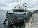 Atlantic Surveyor |
Schwab, W.C., Denny, J.F., Foster, D.S., Lotto, L.L., Allison, M.A., Uchupi, E., Swift, B.A., Danforth, W.W., Thieler, E.R., and Butman, B., 2002, High-resolution Quaternary seismic stratigraphy of the New York Bight Continental Shelf: U.S. Geological Survey Open-File Report 2002-152, DVD-ROM, URL: https://doi.org/10.3133/ofr2002152.
| Survey Equipment | Survey Info | Data Type(s) | Data Collected |
|---|---|---|---|
| Subbottom profiler | CHIRP seismic system - Wesleyan Univ | Sub Bottom Profiler | |
| Gravity corer | --- | Geology | 1994-006-FA-SC-001 (CORE samples) |
