Other ID: ASTR 94-4
Status: Completed
Organization(s): USGS, Woods Hole Coastal and Marine Science Center
Funding Program(s):
Principal Investigator(s): William Danforth
Affiliate Investigator(s):
Information Specialist(s):
Data Type(s): Location-Elevation: Navigation, Sampling: Geology, Imagery: Video, Sonar: Sidescan, Seismics: Sub Bottom Profiler
Scientific Purpose/Goals: Conducted a sidescan sonar survey in a localized area within Massachusetts Bay. Collected video, Van Veen grab samples and slow cores to enable ground truthing of the sonar data.
Vehicle(s):
Start Port/Location: USCG Base, Boston, MA
End Port/Location: USCG Base, Boston, MA
Start Date: 1994-07-05
End Date: 1994-07-08
Equipment Used: Slow corer, SIS1000 Chirp Sonar, Van Veen grab sampler, DGPS, SIS1000 Sidescan sonar, Video camera - deep sea
Information to be Derived: Grain size analysis; Sea floor map;
Summary of Activity and Data Gathered: Sidescan data: 61.5 km; Cores: 7, 2 stored intact; Core subsamples: 15; Van Veen grabs: 16; Video?
Staff: William Danforth, Jane Denny, Thomas O'Brien, Richard Rendigs, Charles R. Denham
Affiliate Staff:
Brian Wilson - Datasonics
Notes:
Project = EEZ Seafloor Mapping, EEZ Seafloor Mapping
Location:
Massachusetts Bay, Massachusetts, United States, North America, North Atlantic,
| Boundaries | |||
|---|---|---|---|
| North: 42.5 | South: 42.3 | West: -71 | East: -70.75 |
Platform(s):
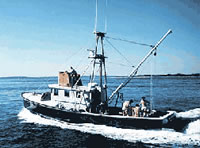
 Asterias |
| Title | Survey Equipment | Description |
|---|---|---|
| Cruise report | (document not focused on specific equipment) | Chief Scientist's report including personnel, purpose, equipment, tabulated information including station locations with data collected. |
| Survey Equipment | Survey Info | Data Type(s) | Data Collected |
|---|---|---|---|
| Slow corer | --- | Geology | 1994-024-FA-SC-001 (CORE, DREDGE, GRAB samples) |
| SIS1000 Chirp Sonar | --- | Sub Bottom Profiler | |
| Van Veen grab sampler | --- | Geology | |
| DGPS | --- | Navigation | 1994-024-FA-LN-001 (Navigation trackline plot for field activity 94024) |
| SIS1000 Sidescan sonar | --- | Sidescan | |
| Video camera - deep sea | --- | Video |