Other ID: CHAP95-1
Status: Completed
Organization(s): USGS, Woods Hole Coastal and Marine Science Center
Funding Program(s):
Principal Investigator(s): Kathryn Scanlon Catanach
Affiliate Investigator(s): Churchill Grimes - NMFS
Information Specialist(s):
Data Type(s): Location-Elevation: Navigation, Seismics: Boomer, Sonar: Sidescan, Seismics: Sub Bottom Profiler
Scientific Purpose/Goals: Map surficial geology of deep-water Oculina reef area and observe grouper spawning aggregations using acoustics and video.
Vehicle(s):
Start Port/Location: Port Canaveral, FL
End Port/Location: Port Canaveral, FL
Start Date: 1995-02-27
End Date: 1995-03-08
Equipment Used: SIS1000 Sidescan sonar, GPS (wh), SIS1000 Chirp Sonar
Information to be Derived:
Summary of Activity and Data Gathered:
Staff: David Nichols, Thomas O'Brien
Affiliate Staff:
Chris Koenig - NMFS
Mark Grace - NMFS
Chris Gledhill - NMFS
Cliff Harper - SSC
ROV
Notes: Project = Oculina Bank, Oculina Bank
Location:
Oculina Bank, Florida, United States, North America, North Atlantic;
| Boundaries | |||
|---|---|---|---|
| North: 28.40187024 | South: 27.4698289 | West: -80.0625639 | East: -79.92067503 |
Platform(s):
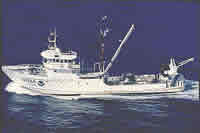 Chapman |
Scanlon, K.M., Briere, P.R., and Koenig, C.C., 1999, Oculina Bank—Sidescan sonar and sediment data from a deep-water coral reef habitat off east-central Florida: U.S. Geological Survey Open-File Report 99-10, CD-ROM, https://doi.org/10.3133/ofr9910.
| Title | Survey Equipment | Description |
|---|---|---|
| Cruise report | (document not focused on specific equipment) | Chief scientist's cruise report including personnel, purpose, equipment, sidescan and chirp seismic line list. |
| Data inventory | (document not focused on specific equipment) | Chief Scientist's inventory of field data. |
| Survey Equipment | Survey Info | Data Type(s) | Data Collected |
|---|---|---|---|
| SIS1000 Sidescan sonar | --- | Sidescan | 1995-014-FA-SO-002 (microfilm of ) 1995-014-FA-SO-003 (Digital tape(s) of SSS/SBTM ) 1995-014-FA-SO-001 ( Collection of paper record displays of sidescan sonar data for lines ) |
| GPS (wh) | --- | Navigation | 1995-014-FA-LN-001-01 (Raw GPS navigation data.) |
| SIS1000 Chirp Sonar | --- | Sub Bottom Profiler | 1995-014-FA-SE-001 (microfilm of ) 1995-014-FA-SE-002 (Digital tape(s) of SSS/SBTM L1) |
