Other ID: CH-95-13,CH-95-15, CH-15-95
Status: Completed
Organization(s): USGS, Woods Hole Coastal and Marine Science Center
Funding Program(s):
Principal Investigator(s): Thomas O'Brien
Affiliate Investigator(s):
Information Specialist(s):
Data Type(s): Location-Elevation: Navigation, Sonar: Sidescan
Scientific Purpose/Goals: Test SIS 7000 sidescan system.
Vehicle(s):
Start Port/Location: Beaufort, NC
End Port/Location: Beaufort, NC
Start Date: 1995-09-06
End Date: 1995-09-11
Equipment Used: DGPS, SIS-7000 sidescan, Q-MIPS sidescan sonar system
Information to be Derived:
Summary of Activity and Data Gathered: Testing resumed: Sep. 27-28, 1995, CH-15-95, FA 95037.
Staff: William Danforth, Barry Irwin, Gregory Miller, Thomas O'Brien
Affiliate Staff:
Larry Kooker - tech - USGS-PMG
Fred Hegg - tech - Datasonics
Notes: Original Center People field contained: Tom O'Brien - chief scientist, Bill Danforth - tech, Barry Irwin - tech, Greg Miller - tech. Original Submitted By field contained: Tom O'Brien, Greg Miller.
Project = Gas Hydrates, Gas Hydrates
Location:
Cape Hatteras, Cape Fear Slide, North Carolina, United States, North America, North Atlantic;
| Boundaries | |||
|---|---|---|---|
| North: 32.47053 | South: 30.80387 | West: -76.9178 | East: -75.25118 |
Platform(s):
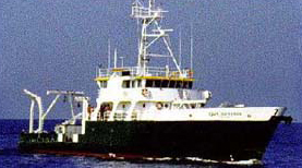 Cape Hatteras |
| Survey Equipment | Survey Info | Data Type(s) | Data Collected |
|---|---|---|---|
| DGPS | --- | Navigation | |
| SIS-7000 sidescan | --- | Sidescan | |
| Q-MIPS sidescan sonar system | --- | Sidescan |
