Other ID: SO108
Status: Completed
Organization(s): USGS, Woods Hole Coastal and Marine Science Center
Funding Program(s):
Principal Investigator(s): Uri Ten Brink
Affiliate Investigator(s):
Information Specialist(s):
Data Type(s): Seismics: Ocean Bottom Seismometer
Scientific Purpose/Goals: Image the crustal structure of the Cascadia continental margin as part of the earthquake hazard assessment in the area.
Vehicle(s):
Start Port/Location: San Francisco, CA
End Port/Location: Vancouver, British Columbia
Start Date: 1996-04-20
End Date: 1996-05-24
Equipment Used: Ocean Bottom Seismometer
Information to be Derived:
Summary of Activity and Data Gathered:
Staff: Gregory Miller, Uri Ten Brink
Affiliate Staff:
Notes:
Project = Cascadia Region Seismic Experiment, Cascadia Region Seismic Experiment
Location:
offshore Washington, Oregon, United States, North America, North Pacific;
| Boundaries | |||
|---|---|---|---|
| North: 48.10058 | South: 42.68244 | West: -129.2534 | East: -123.31055 |
Platform(s):
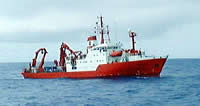 Sonne |
Fisher, M.A., Hyndman, R.D., Johnson, S.Y., Brocher, T.M., Crosson, R.S., Wells, R.E., Calvert, A.J., ten Brink, U.S., 2005, Crustal structure and earthquake hazards of the subduction zone in southwestern British Columbia and western Washington, Chapter C in Kayen, R., ed., Earthquake hazards of the Pacific Northwest coastal and marine regions: U.S. Geological Survey Professional Paper 1661-C, doi: 10.3133/pp1661C.
| Survey Equipment | Survey Info | Data Type(s) | Data Collected |
|---|---|---|---|
| Ocean Bottom Seismometer | --- | Ocean Bottom Seismometer | 1996-002-FA-SE-002 (CD ROM disk of OBS/ RL1-5, SEGY, OBS/ L7-9, SEGY, OBS/ L10, SEGY, OBS/ L10, SEGY, OBS/ L11, SEGY, OBS/ L11, SEGY, OBS/ L11, SEGY, OBS/ L12, SEGY, OBS/ L12, SEGY, OBH/RL 1-6,8,9,GEOMAR, OBH/RL 7,10, GEOMAR, OBH/RL 11, GEOMAR, OBH/RL 12, GEOMAR, ) 1996-002-FA-SE-001 (Digital tape(s) of OBS-RAW-DEPLY1, OBS-RAW-DEPLY2, OBS-RAW-DEPLY3, OBS-RAW-DEPLY4, OBS-RAW-DEPLY5, ) |
