Other ID: none
Status: Completed
Organization(s): USGS, Woods Hole Coastal and Marine Science Center
Funding Program(s):
Principal Investigator(s): Lawrence Poppe
Affiliate Investigator(s):
Information Specialist(s):
Data Type(s): Location-Elevation: Navigation, Sampling: Geology, Biological Field Study: Experiments (biological), Biological Field Study: Surveys (biological), Imagery: Photo, Imagery: Video, Sampling: Biology, Visual Identification: Species ID
Scientific Purpose/Goals: Bottom photo and sedimentological, geochemical, and biological sampling to define sedimentary environments and benthic habitats within eastern Long Island Sound.
Vehicle(s):
Start Port/Location: Old Lyme, CT
End Port/Location: Old Lyme, CT
Start Date: 1996-03-11
End Date: 1996-03-19
Equipment Used: DGPS, Van Veen grab sampler, SeaBOSS
Information to be Derived:
Summary of Activity and Data Gathered:
Staff: Dann Blackwood, Lawrence Poppe, Brenton B. Taylor, Ralph Lewis
Affiliate Staff:
M. Cohen
R. Robertson
Notes: Original Center People field contained: L. Larry Poppe, D. Dann Blackwood, B. Brendt Taylor, R. Lewis, M. Cohen, R. Robertson.
Project = Sediment Texture of Long Island Sound, Sediment Texture of Long Island Sound
Location:
eastern Long Island Sound and adjacent waters, Connecticut, United States, North America, North Atlantic;
| Boundaries | |||
|---|---|---|---|
| North: 41.31818 | South: 40.92156 | West: -72.9811 | East: -72.12788 |
Platform(s):
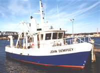 Dempsey |
Poppe, L.J., Danforth, W.W., McMullen, K.Y., Parker, C.E., Lewit, P.G., and Doran, E.F., 2010, Integrated multibeam and LIDAR bathymetry data offshore of New London and Niantic, Connecticut: U.S. Geological Survey Open-File Report 2009-1231, https://doi.org/10.3133/ofr20091231.
Poppe, L.J., Polloni, C., eds., 1998, Long Island Sound environmental studies: U.S. Geological Survey Open-File Report (98-502), https://doi.org/10.3133/ofr98502.
Poppe, L.J., Taylor, B.B., Blackwood, D., Lewis, R.S., and Cohen-DiGiacomo, M.L., 1996, The texture of surficial sediments in eastern Long Island Sound near Niantic Bay, Connecticut: U.S. Geological Survey Open-File Report 96-271, https://doi.org/10.3133/ofr96271.
| Title | Survey Equipment | Description |
|---|---|---|
| Sample log | SeaBOSS | Field log describing data collection by Van Veen sampler, video camera and 35-mm still camera, and sea-floor description in Niantic Bay, CT, March 11-13, 1997. |
| Sample log | SeaBOSS | Field log describing data collection by Van Veen sampler, video camera and 35-mm still camera, and sea-floor description in eastern Long Island Sound, March 13-18, 1997. |
| Survey Equipment | Survey Info | Data Type(s) | Data Collected |
|---|---|---|---|
| DGPS | --- | Navigation | 1996-015-FA-LN-001 (Floppy disk(s) containing NAV DGPS MARK) |
| Van Veen grab sampler | --- | Geology | 1996-015-FA-SC-001 (GRAB samples) |
| SeaBOSS | --- | Surveys (biological) Experiments (biological) Species ID Photo Video Geology Biology |
