Other ID: none
Status: Completed
Organization(s): USGS, Woods Hole Coastal and Marine Science Center
Funding Program(s):
Principal Investigator(s): Uri Ten Brink
Affiliate Investigator(s): Robin Holcomb - PMG; Bruce Nelson - UWA
Information Specialist(s): PARTNER
Data Type(s): Electro-Magnetic: Magnetics, Location-Elevation: Navigation
Scientific Purpose/Goals: Extent and depth of landsliding on submarine northern flank of Molokai.
Vehicle(s):
Start Port/Location: Honolulu, HI
End Port/Location: Honolulu, HI
Start Date: 1996-08-28
End Date: 1996-09-06
Equipment Used: Marine magnetometer, GPS (wh)
Information to be Derived:
Summary of Activity and Data Gathered: 8 dives accomplished out of 8 planned.
Staff:
Affiliate Staff:
Robin Holcolm - PMG-Seattle; Bruce Nelson
B. West - U WA; J-C Carracedo
Canary Volcano Observatory
Tennerife
Spain
Notes: Data Curator: U. Washington.
Project = Extent and depth of landsliding on the submarine northern flank of Molokai, Extent and depth of landsliding on the submarine northern flank of Molokai
Location:
Molokai, Hawaii, United States, North Pacific;
| Boundaries | |||
|---|---|---|---|
| North: 21.2689 | South: 21.12037 | West: -157.3132 | East: -156.71997 |
Platform(s):
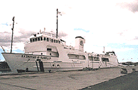 Kaimikai-O-Kanaloa |
| Survey Equipment | Survey Info | Data Type(s) | Data Collected |
|---|---|---|---|
| Marine magnetometer | --- | Magnetics | |
| GPS (wh) | --- | Navigation |
