Other ID: none
Status: Completed
Organization(s): USGS, Woods Hole Coastal and Marine Science Center
Funding Program(s):
Principal Investigator(s): William Schwab
Affiliate Investigator(s): Steve Couch - USACOE
Information Specialist(s): Jane Denny
Data Type(s): Seismics: Boomer, Location-Elevation: Navigation, Seismics: Sub Bottom Profiler, Sonar: Sidescan, Sampling: Biology, Sampling: Geology, Imagery: Photo, Imagery: Video
Scientific Purpose/Goals: High-resolution sea floor mapping nearshore Fire Island, New York.
Vehicle(s):
Start Port/Location: Woods Hole, MA
End Port/Location: Woods Hole, MA
Start Date: 1996-09-04
End Date: 1996-09-24
Equipment Used: GeoPulse uniboom, Benthos AQ-4 10-element hydrophone streamer, SIS1000 Chirp Sonar, DGPS, 3.5 kHz, SIS1000 Sidescan sonar, ISIS, Grab sampler, Camera- deep sea, Video camera - deep sea
Information to be Derived:
Summary of Activity and Data Gathered:
Staff: VeeAnn Cross, William Danforth, Jane Denny, David Foster, Barry Irwin, William Schwab, Kenneth F. Parolski, Eric Haase, Michael Taylor
Affiliate Staff:
Notes: Project is a continuation of USGS high-resolution sea-floor mapping efforts off the NY-NJ Metropolitan area.
Project = EEZ Shelf Mapping; New York Metropolitan Region, EEZ Shelf Mapping; New York Metropolitan Region
Location:
inner shelf out 5 nm, Fire Island, New York, United States, North America, North Atlantic;
| Boundaries | |||
|---|---|---|---|
| North: 40.70053817 | South: 40.50034121 | West: -73.54782254 | East: -72.94799653 |
Platform(s):
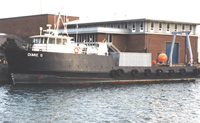 Diane G |
Butman, B., 1998, Mapping the sea-floor geology offshore of the New York - New Jersey metropolitan region: U.S. Geological Survey Fact Sheet 133-98, https://doi.org/10.3133/fs13398.
Butman, B., Danforth, W.W., Schwab, W.C., and Buchholtz ten Brink, M.R., 1998, Multibeam bathymetric and backscatter maps of the upper Hudson Shelf Valley and adjacent shelf, offshore of New York: U.S. Geological Survey Open-File Report 98-616, https://doi.org/10.3133/ofr98616.
Hill, J.C., Schwab, William C., and Foster, David S., 2000, Archive of boomer subbottom data collected during USGS Cruise DIAN 96040, Fire Island, New York, 4-15 September, 1996: U.S. Geological Survey Open-File Report, https://doi.org/10.3133/ofr00467.
Hill, J.C., Schwab, W.C., and Foster, D.S., 2000, Archive of Datasonics SIS-1000 chirp subbottom data collected during USGS Cruise DIAN 96040, Fire Island, New York, 4-24 September 1996: U.S. Geological Survey Open-File Report, https://doi.org/10.3133/ofr00366.
Schwab, W.C., Baldwin, W.E., and Denny, J.F., 2014, Maps showing the change in modern sediment thickness on the Inner Continental Shelf Offshore of Fire Island, New York, between 1996–97 and 2011: U.S. Geological Survey Open-File Report 2014–1238, https://doi.org/10.3133/ofr20141238.
Schwab, W.C., Denny, J.F., and Baldwin, W.E., 2014, Maps showing bathymetry and modern sediment thickness on the inner continental shelf offshore of Fire Island, New York, pre-Hurricane Sandy: U.S. Geological Survey Open-File Report 2014–1203, https://doi.org/10.3133/ofr20141203.
Schwab, W.C., Thieler, E.R., Denny, J.F., and Danforth, W.W., 2000, Seafloor sediment distribution off southern Long Island, New York: U.S. Geological Survey Open-File Report 2000-243, URL: https://doi.org/10.3133/ofr00243.
FAN 1996-040-FA has data viewable in the GeoMappApp/Virtual Ocean applications. To view this data in these applications go to http://www.geomapapp.org/ and http://www.virtualocean.org/. See the instructions for locating USGS data in these applications. You can also view the imagery created from the SEGY data at https://cmgds.marine.usgs.gov/images.php?cruise=1996-040-FA.
| Title | Survey Equipment | Description |
|---|---|---|
| Navigation log | (document not focused on specific equipment) | Navigation log containing lines numbers, start and end times, diskette changes, data acquisition notes, station times, trackmap. |
| Survey Equipment | Survey Info | Data Type(s) | Data Collected |
|---|---|---|---|
| GeoPulse uniboom | --- | Boomer | |
| Benthos AQ-4 10-element hydrophone streamer | --- | Air Gun / Water Gun Boomer Sparker | 1996-040-FA-SE-001-01 (Boomer Subbottom Data - SEG-Y data files and images.) Boomer seismic data |
| SIS1000 Chirp Sonar | --- | Sub Bottom Profiler | Chirp seismic data 1996-040-FA-SE-001-02 (CHIRP Subbottom Data - SEG-Y data files and images.) 1996-040-FA-SE-002 (Remastered DVD disk of Chirp subbottom data, lines 1-79.) |
| DGPS | --- | Navigation | 1996-040-FA-LN-001-01 (Processed navigation) Chirp navigation Boomer navigation |
| 3.5 kHz | --- | Sub Bottom Profiler | |
| SIS1000 Sidescan sonar | --- | Sidescan | |
| ISIS | --- | Sidescan | |
| Grab sampler | --- | Biology Geology | 1996-040-FA-SC-001 (GRAB samples) |
| Camera- deep sea | --- | Photo | |
| Video camera - deep sea | --- | Video |
