Other ID: M3-98-WO
Status: Completed
Organization(s): USGS, Woods Hole Coastal and Marine Science Center
Funding Program(s):
Principal Investigator(s): William Schwab
Affiliate Investigator(s): Pat McCrory (USGS Earthquake, Menlo Park)
Information Specialist(s): PARTNER
Data Type(s): Location-Elevation: Navigation, Location-Elevation: Transects, Seismics: Sparker, Seismics: Sub Bottom Profiler, Sonar: Single Beam, Sonar: Sidescan, Seismics: Boomer
Scientific Purpose/Goals: High-resolution sea floor mapping using SIS-1000 and GeoPulse/Sparker sub-bottom. PI requests technical support from Woods Hole.
Vehicle(s):
Start Port/Location: Seattle, WA
End Port/Location: Aberdeen, WA
Start Date: 1998-06-21
End Date: 1998-07-05
Equipment Used: SIS1000 Chirp Sonar, GeoPulse uniboom, DGPS, SIS1000 Sidescan sonar, Sparker , Benthos 7000 , Single channel hydrophone, Echosounder
Information to be Derived:
Summary of Activity and Data Gathered: Cruise was very successful with little down time. Raw sidescan and seismic data archived on CD-ROM and is being open-filed (Oct. 1998).
Staff: William Danforth, David Foster, Thomas O'Brien
Affiliate Staff:
Pat McCrory
USGS-Earthquake
Menlo Park
Notes: Woods Hole supported Pat's operations last year (FA 97013). She is basically requesting the same this year, and WHFC personnel responded. Data Curator: Pat McCrory.
Project = Cascadia Project, Cascadia Project
Information from Foghorn:SIS-1000, GeoPulse Boomer, Digital data acquisition (ISIS), Sparker, Benthos 7000 (fish range), Furuno Fathometer;
Location:
inner shelf, Washington, United States, North America, North Pacific;
| Boundaries | |||
|---|---|---|---|
| North: 48.5 | South: 46.5 | West: -125 | East: -124 |
Platform(s):
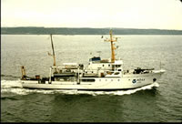 McArthur |
Foster, D.S., McCrory, P. A., Danforth, W. W., and O'Brien, T. F., 1999, Archive of boomer and sparker subbottom data collected during USGS Cruise MCAR 98008 (M3-98-WO) Washington Shelf, 24 June-5 July, 1998: U.S. Geological Survey Open-File Report 99-592, https://doi.org/10.3133/ofr99592.
Foster, D.S., McCrory, P.A., Danforth, W.W., and O'Brien, T.F., 1999, Archive of Chirp subbottom data, collected during USGS Cruise MCAR 98008 (M3-98-WO) Washington Shelf, 24 June-5 July, 1998: U.S. Geological Survey Open-File Report 99-591, https://doi.org/10.3133/ofr99591.
McCrory, P.M., Danforth, W.W., O'Brien, T.F., and Foster, D.S., 2001, Archive of sidescan-sonar data and DGPS navigation data collected during USGS Cruise 98008; Washington shelf, 24 June-5 July, 1998: U.S. Geological Survey Open-File Report 2001-507, https://doi.org/10.3133/ofr01507.
FAN 1998-008-FA has data viewable in the GeoMappApp/Virtual Ocean applications. To view this data in these applications go to http://www.geomapapp.org/ and http://www.virtualocean.org/. See the instructions for locating USGS data in these applications. You can also view the imagery created from the SEGY data at https://cmgds.marine.usgs.gov/images.php?cruise=1998-008-FA.
| Survey Equipment | Survey Info | Data Type(s) | Data Collected |
|---|---|---|---|
| SIS1000 Chirp Sonar | --- | Sub Bottom Profiler | 1998-008-FA-SE-003 (Raw CHIRP seismic data) Chirp seismic data |
| GeoPulse uniboom | --- | Boomer | |
| DGPS | --- | Navigation | 1998-008-FA-LN-001 (Navigation data) |
| SIS1000 Sidescan sonar | --- | Sidescan | |
| Sparker | --- | Sparker | |
| Benthos 7000 | --- | Navigation Transects | |
| Single channel hydrophone | --- | Air Gun / Water Gun Boomer Bubble Gun Sparker Sub Bottom Profiler | 1998-008-FA-SE-002 (Raw boomer seismic Data) 1998-008-FA-SE-004 (Raw Sparker seismic data) Sparker seismic data Boomer seismic data 1998-008-FA-SE-001 (Seismic data) |
| Echosounder | --- | Single Beam |
