Other ID: none
Status: Completed
Organization(s): USGS, Woods Hole Coastal and Marine Science Center
Funding Program(s):
Principal Investigator(s): Claude (Wylie) Poag
Affiliate Investigator(s):
Information Specialist(s): Nancy K. Soderberg
Data Type(s): Electro-Magnetic: Gravity, Location-Elevation: Navigation, Seismics: Air Gun / Water Gun
Scientific Purpose/Goals: A one-day seismic reflection and marine gravity survey of the Chesapeake Bay bolide impact crater.
Vehicle(s):
Start Port/Location: Portsmouth, VA
End Port/Location: Norfolk, VA
Start Date: 1998-10-15
End Date: 1998-10-16
Equipment Used: Gravity meter (wh), GPS (wh), Air gun, Single channel hydrophone
Information to be Derived:
Summary of Activity and Data Gathered:
Staff: David Foster, Claude (Wylie) Poag
Affiliate Staff:
Joe Stennet
LDEO
Science Officer; Jeff Turmelle
LDEO
data reduction; Woody Hobbs
VIMS
faculty guest
watch stander; Bob Gammisch
VIMS
faculty guest
watch stander; George Pongonis
VIMS
faculty guest
watch stander; Steve Goodbred
VIMS
graduate student guest
watch stander; James Hall
Old Dominion U.
graduate student guest
watch stander; Shonia Becraft
Old Dominion U.
undergrad. student guest
watch stander
Notes: Original Center People field contained: C. Wylie Poag - Principal Investigator; Dave Foster - Shipboard Chief Scientist.
Project = Chesapeake Bay Bolide, Chesapeake Bay Bolide
Location:
Chesapeake Bay, United States, North America, North Atlantic;
| Boundaries | |||
|---|---|---|---|
| North: 37.475 | South: 36.87167 | West: -76.3642 | East: -75.7575 |
Platform(s):
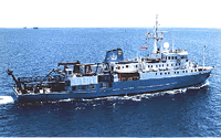 Maurice Ewing |
| Title | Survey Equipment | Description |
|---|---|---|
| Cruise report | (document not focused on specific equipment) | Equipment configuration and performance, processing steps for GPS navigation, Bell gravimeter and land-ties, Furono speed log, Young weather station, Omega sea temperature and airgun and streamer line data, scientific personnel, cruise summary. |
| Survey Equipment | Survey Info | Data Type(s) | Data Collected |
|---|---|---|---|
| Gravity meter (wh) | --- | Gravity | 1998-051-FA-GP-001 (Digital tape(s) of AIRGUN,GRAV-BAY1, AIRGUN,GRAV-BAY2, AIRGUN,GRAV-BAY3, AIRGUN,GRAV-BAY1-3, ) |
| GPS (wh) | --- | Navigation | |
| Air gun | --- | Air Gun / Water Gun | |
| Single channel hydrophone | --- | Air Gun / Water Gun Boomer Bubble Gun Sparker Sub Bottom Profiler | 1998-051-FA-SE-002 (CD ROM disk of AIRGUN GRAV RAW, PROCESSED 1-3, ) 1998-051-FA-SE-001 (Digital tape(s) of AIRGUN,GRAV-BAY1, AIRGUN,GRAV-BAY2, AIRGUN,GRAV-BAY3, AIRGUN,GRAV-BAY1-3, ) |
