Other ID: none
Status: Completed
Organization(s): USGS, Woods Hole Coastal and Marine Science Center
Funding Program(s):
Principal Investigator(s): Gregory Miller
Affiliate Investigator(s):
Information Specialist(s):
Data Type(s): Location-Elevation: Navigation, Seismics: Ocean Bottom Seismometer, Seismics: Sub Bottom Profiler
Scientific Purpose/Goals: Test external sensor pack configurations in recording earthquakes.
Vehicle(s):
Start Port/Location: Long Beach, CA
End Port/Location: Long Beach, CA
Start Date: 1999-06-10
End Date: 1999-07-07
Equipment Used: Ocean Bottom Seismometer, GPS (wh), 3.5 kHz
Information to be Derived:
Summary of Activity and Data Gathered: Deployment (5) - Greg and Rick, 6/7-6/11. Recovery of lost OBS - Greg and Nancy, 6/16-6/19. Deployment (2) - Greg, Joe and Jeff, 6/21-6/23. Recovery (6) - Greg, Rick and Jeff, 7/6-7/9.
Staff: Jefferey Nealon, Joseph S. Newell, Richard Rendigs, Nancy K. Soderberg
Affiliate Staff:
Notes: Original Center People field contained: Greg Miller - Tech, Rick Rendigs - Tech, Nancy Soderberg - Tech, Joe Newell - Tech, Jeff Neelan - Tech.
Location:
Los Angeles, California, United States, North America, North Pacific,
| Boundaries | |||
|---|---|---|---|
| North: 35 | South: 33 | West: -119 | East: -118 |
Platform(s):
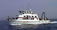 Sea Watch |
| Survey Equipment | Survey Info | Data Type(s) | Data Collected |
|---|---|---|---|
| Ocean Bottom Seismometer | --- | Ocean Bottom Seismometer | 1999-028-FA-NL-001 (OBS, tapes) |
| GPS (wh) | --- | Navigation | |
| 3.5 kHz | --- | Sub Bottom Profiler | 1999-028-FA-NL-002 (paper records 3.5K) |
