Other ID: IB F-11-00-ST; FERL0011
Status: Completed
Organization(s): USGS, Woods Hole Coastal and Marine Science Center
Funding Program(s):
Principal Investigator(s): Page Valentine
Affiliate Investigator(s):
Information Specialist(s): Page Valentine
Data Type(s): Imagery: Photo, Imagery: Video, Sampling: Geology, Location-Elevation: Navigation
Scientific Purpose/Goals: Geological and biological observations; video/photo/grab sampling. Research area is 42deg05 N to 42deg48 N and 70deg02 W to 70deg36 W.
Vehicle(s):
Start Port/Location: Woods Hole, MA
End Port/Location: Woods Hole, MA
Start Date: 2000-06-05
End Date: 2000-06-09
Equipment Used: SeaBOSS, Digital camera, P-code GPS
Information to be Derived:
Summary of Activity and Data Gathered: 63 stations total; 58 sediment samples, 63 video/photo tracks.
Staff: Robert Barton, Dann Blackwood, Ben Gutierrez, Erika Hammar-Klose, Barry Irwin, Jeremy Malczyk, Joseph S. Newell, Christopher F. Polloni, Page Valentine, Charles Worley
Affiliate Staff:
Notes: Mobilization will be on Saturday, June 3 in Woods Hole. Depart Woods Hole early Monday, June 5. No sidescan sonar or other towed systems will be deployed. Note: mob date changed from Friday to Saturday am. Original Center People field contained: At sea: Page Valentine, Dann Blackwood, Malczyk, Chuck Worley, Hammar-Klose, Gutierrez, Polloni. Mob/demob: Joe Newell, Barry Irwin, Barton.
Project = Stellwagen Bank NMS Mapping Project, Stellwagen Bank NMS Mapping Project
Information from Foghorn: SEABOSS system w/winch;video van;P-code navigation;geolink system;
Location:
Stellwagen Bank, North America, North Atlantic;
| Boundaries | |||
|---|---|---|---|
| North: 42.405 | South: 42.089 | West: -70.612 | East: -70.412 |
Platform(s):
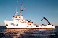 Ferrel |
Valentine, P.C., Gallea, L.B., Blackwood, D.S., and Twomey, E.R., 2010, Seabed photographs, sediment texture analyses, and sun-illuminated sea floor topography in the Stellwagen Bank National Marine Sanctuary region off Boston, Massachusetts: U.S. Geological Survey Data Series 469, available at https://doi.org/10.3133/ds469.
Valentine, P.C., Baker, J.L., Unger, T.S., Scully, L.A., and Fuller, S.J., 2005, Sea floor image maps showing topography, sun-illuminated topography, backscatter intensity, ruggedness, slope, and the distribution of boulder ridges and bedrock outcrops in the Stellwagen Bank National Marine Sanctuary region off Boston, Massachusetts: U.S. Geological Survey Scientific Investigations Map 2840, https://doi.org/10.3133/sim2840.
| Survey Equipment | Survey Info | Data Type(s) | Data Collected |
|---|---|---|---|
| SeaBOSS | --- | Surveys (biological) Experiments (biological) Species ID Photo Video Geology Biology | 2000-011-FA-SC-001 (GRAB samples) 2000-011-FA-PH-001 (CD ROM disk of BOTTOMPHOTO STELL) |
| Digital camera | --- | Photo | 2000-011-FA-PH-002 (Deck photos of field activity operations) |
| P-code GPS | --- | Navigation |
